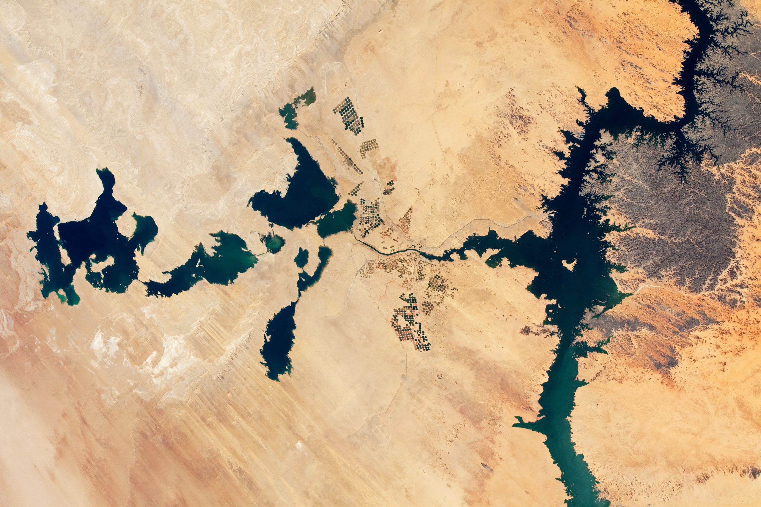
Photographs of the Egyptian desert taken by astronauts aboard the International Space Station show how artificial lakes in the Egyptian desert have filled up reaching never-before-seen extent.
Huge artificial lakes in the desert south of Egypt have reached never-before-seen sizes due to excess water from the great Nasser reservoir on the Nile River.
The level of the Toshka Lakes depends on multi-year fluctuations in the Nile’s flow; the lakes filled in 2002 after the Nile experienced several years of significant flooding. By 2012, however, most of the lakes had dried up due to low river flow. In subsequent years, the lakes shrank further, leaving only small remnants of water in the western basins.
As of 2019, summer rains in Sudan and South Sudan were heavy enough to raise the water level in Lake Nasser, permitting the eastern Toshka Basin to begin to fill.
In 2020, record flooding occurred in Sudan, resulting in the highest water level ever recorded in Lake Nasser.
Again in 2021, the Sudanese floods approached record levels. Furthermore, the result was a rapid filling of the Toshka Lakes.
The November 2021 photo released by NASA (see below) shows the lakes house more water than ever before, with Lake Nasser stretching across the Nile to the right, next to the spillway that feeds the lakes.
Artificial Lakes in the Egyptian desert reach an unprecedented extent
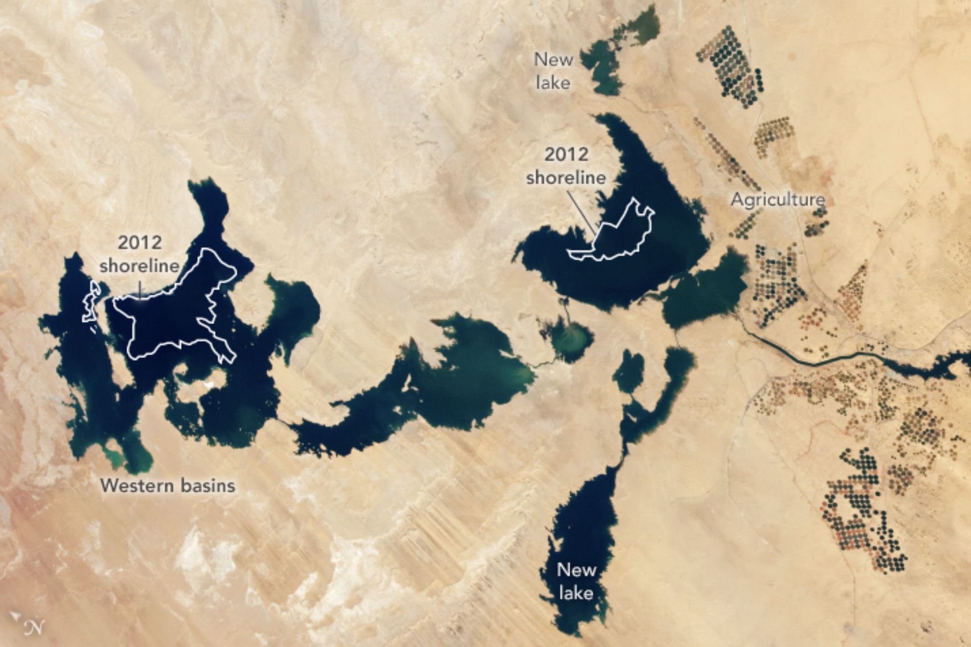
Satellite images show that new lakes have formed in depressions to the north and south of the eastern basin.
The area of the original lakes even grew slightly above the levels seen in 2001.
The areas under cultivation have also greatly expanded in the 19 years since the first available satellite photo.
According to NASA, the ambitious Toshka Lakes project was designed to provide irrigation for new agricultural developments and attract people to the region away from the dense populations of the Nile Valley itself.
The project was also meant to protect the Aswan High Dam, which retains a large volume of water.
Damage to the dam or collapse from overfilling Lake Nasser would be catastrophic for downstream Egyptian populations. On the other hand, overfilling may result from sustained high rainfall in upstream countries. Furthermore, releases from dams in other countries, such as Sudan and Ethiopia, may contribute to overflowing during flood events.
Read More: NASA; Two Decades of Change at Toshka Lakes
Join the discussion and participate in awesome giveaways in our mobile Telegram group. Join Curiosmos on Telegram Today. t.me/Curiosmos