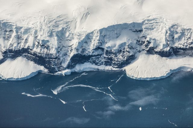
Scientists have made a surprising discovery while surveying Antarctica, a massive 460-kilometer-long River beneath the icy continent.
According to a study published in Nature Geoscience, scientists have found a massive river under Antarctica. The river has a significant impact on flow and melting. This may accelerate ice loss as the climate warms. The 460-kilometer-long river, which collects water from the base of the Antarctic ice sheet, was discovered by Imperial College London scientists. Scientists found that the ice sheet’s base has a higher active flow of water than previously believed. As a result, it makes it more susceptible to climate change.
As the paper’s co-author, Professor Martin Siegert of Imperial College London, explained, when scientists first discovered lakes beneath the Antarctic ice decades ago, they believed they were isolated from one another. Scientists are now beginning to understand that whole systems are beneath the ice. These systems are interconnected by rivers, just as if there wasn’t so much ice covering them up.
New data
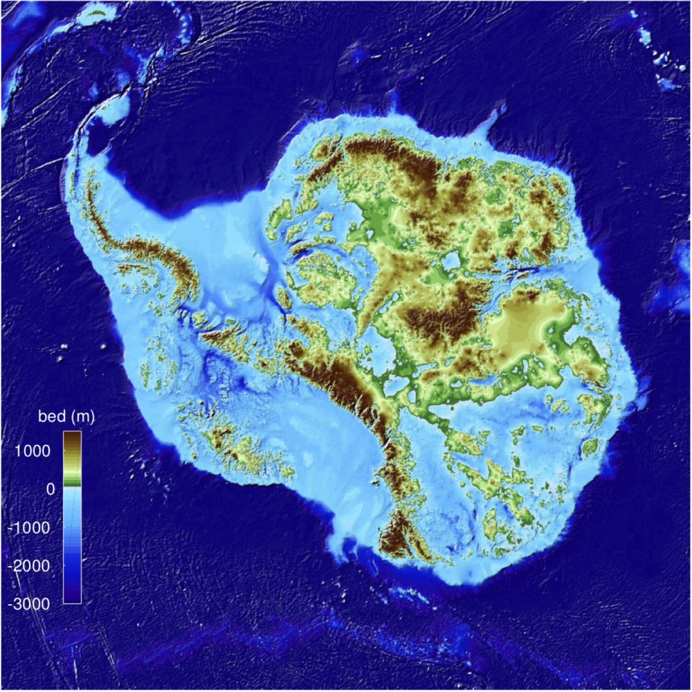
It is estimated that the ice in the region where this study is based could raise sea levels by 4.3 meters globally. There is a direct relationship between how slippery the base of the ice is and how much ice melts. There are two main ways water can appear underneath ice sheets. One by running down through deep crevasses by surface meltwater. The other by melting at the base due to the natural heat of the Earth and friction as the ice moves over land. This new river system may have a strong impact on this process. Polar ice sheets, however, have distinct characteristics.
Over the summer months, Greenland’s surface melts rapidly. This allows immense amounts of water to channel down through deep crevasses known as moulins. In Antarctica, however, the summer temperatures are too cold to melt enough surface water to create moulins. As a result, it was thought that the Antarctic ice sheets had relatively little water at their bases.
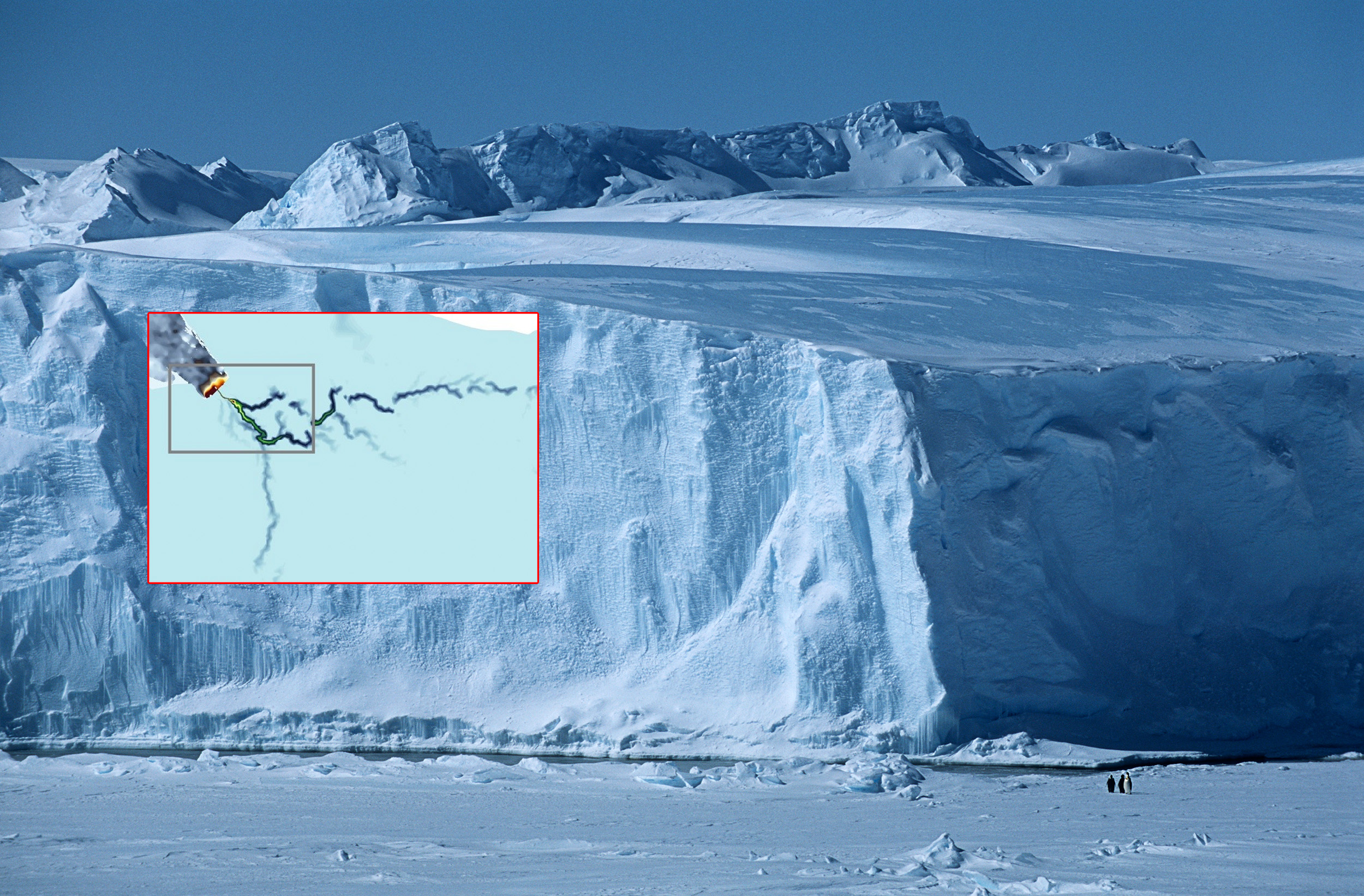
Airborne radar surveys
The new discovery reverses this idea. It shows enough water can be obtained from basal melt to create rivers underneath kilometers-thick ice. Researchers made the discovery using airborne radar surveys and modeling the ice sheet’s hydrology to look beneath the ice. They focused on an area with ice from both the East and West Antarctic Ice Sheets and reaches the Weddell Sea. The area is mainly inaccessible and understudied. According to lead researcher Dr. Christine Dow from the University of Waterloo, the discovery of such an enormous system shows how much we still know about the continent. The newly found river runs into the sea underneath a floating ice shelf. Now the team is trying to collect more data from surveys to apply their models to other regions and provide a better understanding of how a changing Antarctica could affect the planet in the future.
Have something to add? Visit Curiosmos on Facebook. Join the discussion in our mobile Telegram group.