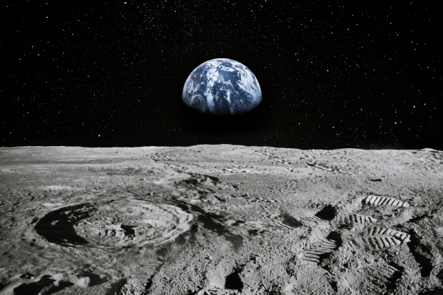
A view of the far side of the Moon in all its beauty brought to you by the Chinese mission that landed on the far side of the Moon.
China’s Chang’e-4 lander and Yutu-2 rover are still returning new views from the far side of the Moon, offering close-up looks at a landscape that is both familiar and fundamentally different from the hemisphere that faces Earth. The images are more than scenic: they are field notes from the first mission to make a soft landing on the lunar far side, in terrain shaped by older impacts and fewer broad lava plains than the near side.
Chang’e-4 touched down on January 3, 2019, inside the Von Kármán crater within the South Pole–Aitken basin, and deployed the Yutu-2 rover soon after, according to mission descriptions from the China National Space Administration and basic mission summaries. That landing mattered for a practical reason as well as a scientific one: the far side does not have a direct line of sight to Earth, so Chang’e-4 relies on a relay satellite rather than a straight radio link.
A far side that is not “dark,” just hidden
A lot of popular writing still calls the far side the “dark side,” but that is a visibility mistake, not a lighting fact. The Moon is tidally locked, so the same hemisphere generally faces Earth, leaving the far side mostly out of view from the ground. It still gets sunlight and darkness on roughly the same rhythm as the near side: about two weeks of daylight followed by about two weeks of night, the cycle that forces solar-powered landers and rovers to power down for the deep cold of lunar night.
When Chang’e-4 and Yutu-2 “wake up,” it is typically after a planned dormant period. Reporting tied to mission updates has described the lander and rover resuming work for the mission’s 24th lunar day in November 2020, after coming out of sleep mode as the Sun returned to their landing site.
What the new images add
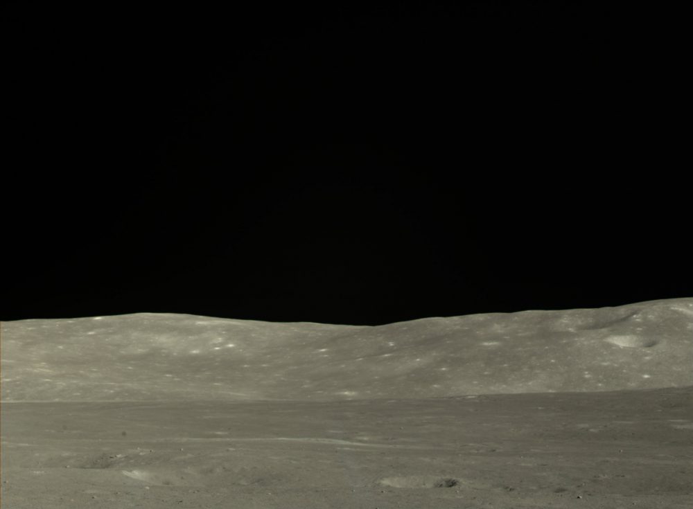
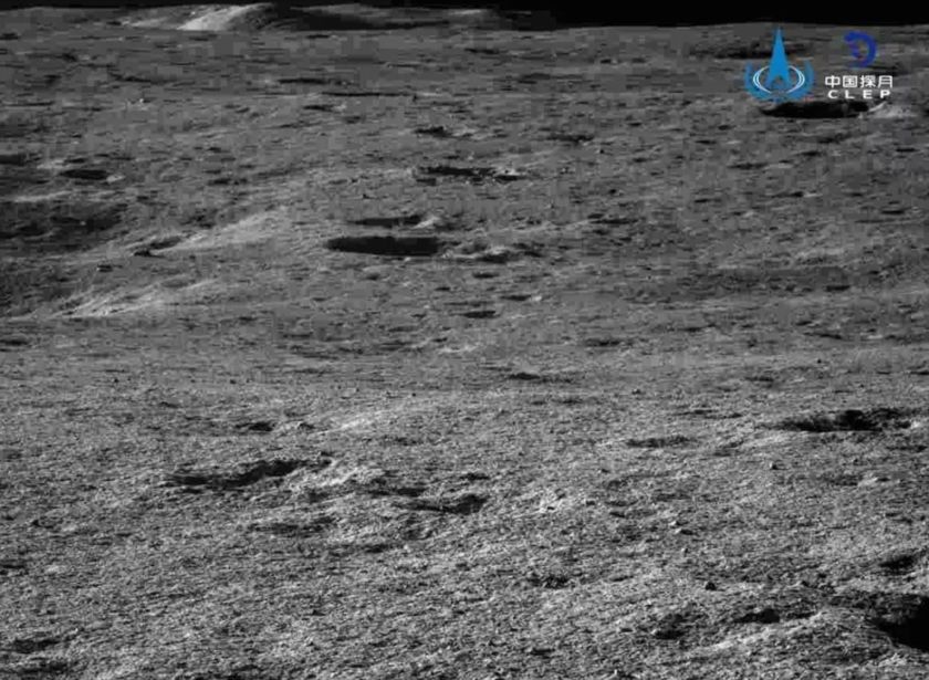
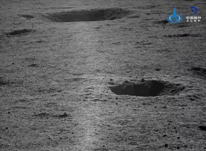
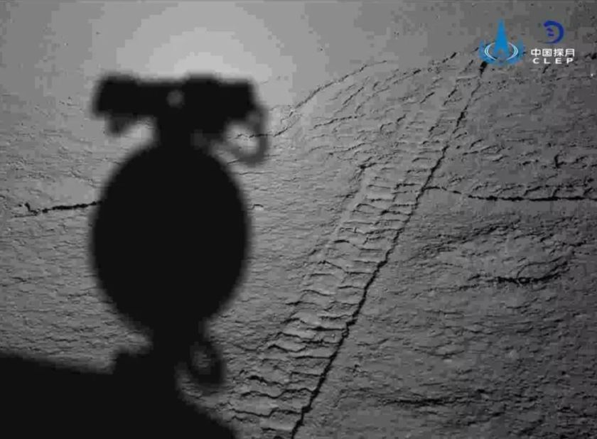
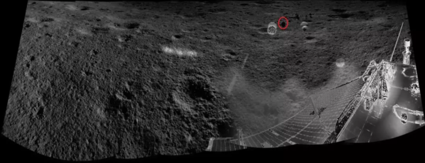
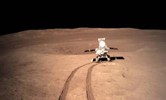
CNSA has periodically released panoramic views and rover imagery showing the immediate surroundings of the lander and the rover’s route across the regolith, including 360-degree panoramas from cameras mounted on the spacecraft. Independent coverage of these data drops has highlighted that the releases often include both high-resolution stills and wide panoramas that help researchers and the public track where the rover has been and what it has been driving toward.
The visual story is consistent across releases: rougher topography, many craters at different scales, and fewer smooth, dark basalt “seas” than on the near side. Those broad basalt plains, called maria, dominate many of the near-side views people associate with the Moon. On the far side, they exist, but in much smaller coverage, leaving a surface that reads as older and more heavily cratered at first glance. That difference is not cosmetic. It is one reason the far side is so valuable for understanding the Moon’s early history and the deep excavation caused by ancient impacts.
Why South Pole–Aitken is a geological prize
Chang’e-4 landed in the South Pole–Aitken basin, a feature that sits at the center of many modern debates about the Moon’s deep structure. NASA describes the basin as the Moon’s largest impact feature, roughly 2,500 kilometers across, and among the largest impact craters known in the Solar System.
For planetary scientists, that scale matters because a basin-forming impact does not just scar the crust. It can dig deep enough to excavate material that is otherwise buried, potentially exposing rocks closer to the mantle than most missions can sample at the surface. The basic idea is straightforward: the deeper the impact, the better the chance of tossing older, deeper material upward where a rover can analyze it without drilling kilometers down.
The mission’s core scientific goal: compare worlds on one Moon
Chang’e-4’s stated science goals include studying the composition of the soil and rocks at its landing site and comparing the far side’s materials to what is known from the near side, where most landers and all Apollo crews operated. That comparison matters because the Moon’s two hemispheres are not symmetrical in crust thickness, volcanic history, or surface chemistry, and far-side measurements help constrain models that try to explain those differences.
One reason Chang’e-4 has drawn sustained interest is the possibility that it is traversing ground where impacts have exposed deeper, more mafic material. Mafic rocks are richer in iron and magnesium than the lighter rocks that dominate much of the lunar highlands, and they can be clues to volcanic history or to material uplifted from depth.
As explained by the Planetary Society, many details of the mission have still not emerged, but experts with the project revealed that the area currently being explored on the moon shows ‘potential evidence of excavated deep mafic material, which could reveal the mineralogy of the lunar mantle.’
That line is careful for a reason. “Potential evidence” is not the same as a confirmed mantle sample. But it sets the scientific frame: Chang’e-4 is operating in a place where the far side’s battered surface may have delivered deeper rocks to the rover’s reach.
A mission that outlived its design life
The other through-line in Chang’e-4 updates is longevity. The lander and rover were designed for relatively short surface operations compared with what they have delivered, and the mission has repeatedly pushed beyond early expectations. Coverage of later operations in 2020 described both vehicles continuing to function well past their planned lifetimes and entering yet another lunar day with ongoing imaging and instrument work.
That endurance is not a footnote. Every additional lunar day increases the rover’s traverse distance, expands the variety of rocks and soils it can analyze, and improves the context for interpreting any “odd” materials the instruments detect. Even a single new panorama can help researchers reconstruct the local geology: the distribution of boulders, small crater fields, regolith textures, and the subtle slope lines that suggest how ejecta settled after impacts.
For readers used to near-side imagery, the far side’s photos can feel austere. That is partly the point. The far side’s surface preserves a different record, one less overwritten by the broad basalt floods that painted much of the near side darker and smoother. If Chang’e-4 and Yutu-2 continue operating, their images and measurements will keep building that record one traverse and one panorama at a time, turning the “hidden” hemisphere into a mapped workplace rather than a blank half of the Moon.