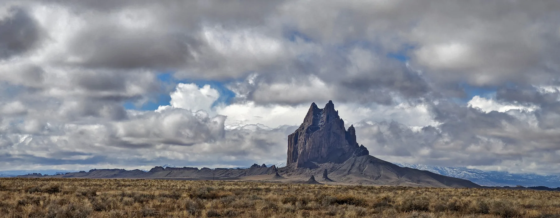
Shiprock seems to have been left behind by another landscape. A jagged peak rises from the plain in northwestern New Mexico, with long walls of dark rock running away from it. The surrounding ground is comparatively low and open. Where did the rest of the mountain go?
Part of the answer is that the rock we see was once underneath the ground. Erosion has exposed the interior of a volcanic system, including the passages through which molten rock travelled. Imagine removing the upper floors of a building until its buried foundations stand in the open. At Shiprock, the missing material was a great thickness of the Earth’s surface.
For the Diné, or Navajo people, the peak is Tsé Bit’a’í, a name Navajo Nation Tourism translates as “rock with wings.” The rock is sacred, and the Navajo Nation prohibits climbing it. From a distance, its spreading walls offer a rare view of a volcano’s buried interior.
Inside a vanished volcano
A familiar volcano has slopes built from lava or material thrown out during eruptions. Shiprock’s steep, broken outline gives a different view. It preserves rock from the volcano’s plumbing, after erosion removed much of the landscape that once surrounded it.
The New Mexico Bureau of Geology and Mineral Resources describes a volcanic neck made largely of breccia, with veins of lava running through it. Breccia is rock assembled from fragments: pieces broken apart and later bound together. Here, its battered contents record violent activity in the conduit.
The jagged summit belongs to that buried conduit. The crater and much of the original landscape have gone; these harder rocks survived as their surroundings wore away.
If we could put the vanished ground back, how much of Shiprock would disappear below it? The bureau places the exposed rocks roughly 750 to 1,000 metres beneath the former surface. That estimate is a reconstruction of the old landscape, rather than a measurement of a surviving cone.
Molten rock found a way through the cracks
The walls extending from Shiprock are called dikes. They formed when magma entered fractures in the surrounding rock and solidified there. A crack that opened underground became a sheet of igneous rock.
At first, such a sheet might have been hidden completely. Later, water, wind and weather removed the enclosing material. Where the solidified magma resisted erosion better than its surroundings, it remained as a ridge. A structure that began as the contents of a fracture became a wall standing above the plain.
Think of a cast taken from a narrow gap. The cast preserves the gap’s shape after the material around it has gone. Dikes can work rather like that, although the fractures are irregular and the rocks have undergone millions of years of change.
The bureau identifies several dikes radiating from Shiprock. Together with the central neck, they let us follow parts of the underground system across the present surface. Their directions show where magma found fractures in the surrounding ground.
A whole volcanic field, now worn down
Shiprock belongs to the Navajo volcanic field, which extends across parts of the Four Corners region. Oregon State University’s Volcano World describes a field covering roughly 20,000 square kilometres, with activity about 30 to 25 million years ago.
The dates cover volcanic activity across the field’s many centres, rather than every rock exposed at Shiprock. All the same, they take us tens of millions of years back from the cliffs we see today.
The field includes rocks called minettes, rich in potassium, and other unusual volcanic rocks. Their composition helps geologists investigate the mantle sources of the magma. At the surface, the fragment-rich volcanic deposits also point to explosive eruptions involving gas-charged magma.
Today, surviving necks are separated by broad stretches of lower ground. Their isolation can make them seem unrelated. Geologists instead compare their rocks, ages and positions to reconstruct a field whose original surface features have largely disappeared.
With the volcano worn away, geologists can examine structures that were once buried hundreds of metres below it.
The wings look different from space
A ground-level photograph emphasizes the cliffs. A satellite view makes the longer lines easier to follow. In a NASA Earth Observatory image acquired on June 2, 2006, the peak and its radiating dikes can be seen within a much wider patch of terrain.
The image came from ASTER, an instrument aboard the Terra satellite. It uses infrared observations to produce a false-color view. Vegetation appears red; other tones distinguish different surfaces. Those colors help the viewer read the ground, but they are not the colors a person would see from the road.
Maps and satellite images also help separate the main peak from the surrounding dikes. In a photograph, perspective can hide the distance between two ridges or make separate features overlap. Looking from above gives another way to test that first impression.
Neither viewpoint supplies a complete underground cross-section. The visible lines show where resistant rock is exposed now. Reconstructing the original volcanic system still requires field observations and comparison with the rock record.
A sacred peak in Diné country
The Diné name calls attention to the relationship between the peak and its spreading rock formations. It also belongs to a cultural landscape. Navajo Nation Tourism identifies Shiprock as sacred, rather than simply a dramatic stop on a road trip.
NASA shares an account in which the peak was a nest associated with giant birds and the Hero Twins, crediting help from the Navajo Nation Museum. The winged outline we see in photographs has a place in stories as well as in geological descriptions.
The geological account explains how magma and erosion shaped the peak. Diné accounts tell us why it is sacred and why approaching it requires respect for the Nation’s guidance.
At Cueva de los Tayos in Shuar territory, too, an extraordinary landform is part of a community’s homeland. Exploring the place means paying attention to the people whose history belongs there.
Seeing Shiprock without climbing it
The Nation’s visitor guidance is direct: view the peak from the paved roads, including Indian Service Route 13 and U.S. 491. Hiking, climbing and camping at the peak are prohibited. The dirt routes around it are not an invitation to approach.
There is still plenty to see from a distance. The central rock and its walls preserve different parts of the same volcanic story. One marks the conduit; the others trace fractures filled by magma. Their shapes invite us to imagine the great volume of ground that used to lie around them.
To picture the old volcano, start with those walls and imagine them enclosed in rock. Shiprock’s wings once lay underground.