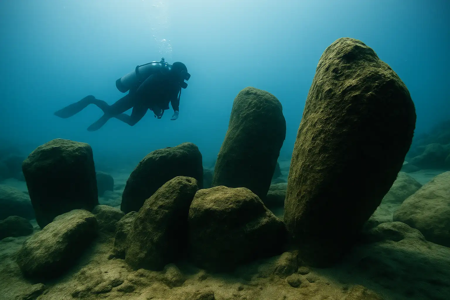
Off Israel’s Carmel coast, a submerged Neolithic settlement contains houses, wells, burials, and a ring of standing stones built around freshwater.
A few hundred meters off Israel’s Carmel coast, Atlit Yam lies on the seabed in shallow Mediterranean water. Archaeologists describe it as the earliest known permanent coastal settlement yet identified, a late Stone Age village where houses, wells, graves, and standing stones still mark the ground plan of a community that lived beside both sea and freshwater about 9,000 years ago.
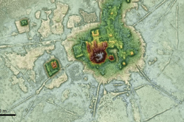
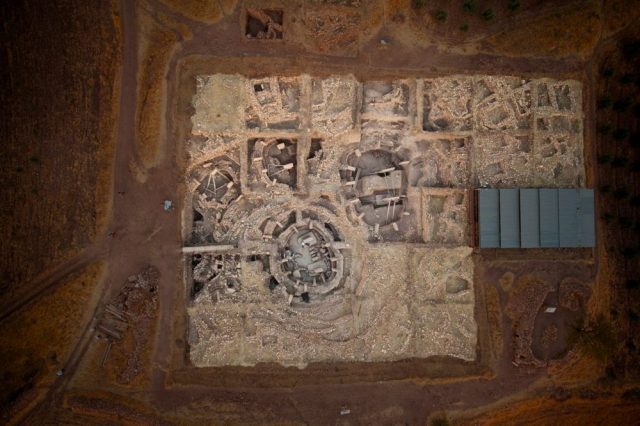
The site was found in 1984 and later surveyed and excavated underwater. It lies about 200 to 400 meters offshore at a depth of roughly 8 to 12 meters, spread across at least 40,000 square meters. On that seabed archaeologists have traced rectangular stone-built houses, hearths, food-processing areas, graves, and some of the earliest constructed water wells known anywhere. Atlit Yam was not a stopover camp. Its layout points to a settled place, with built rooms, repeated use of the same ground, and a water system tied to the coastal aquifer.
The standing stones
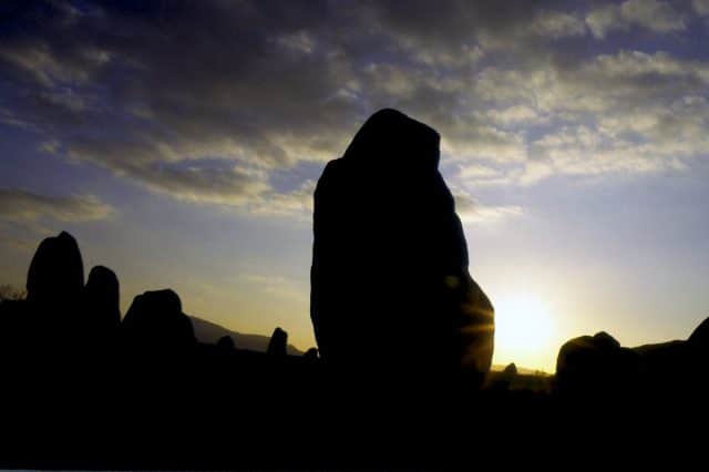
Near the center of the village is the feature that has drawn most attention: a group of upright stones described by excavators as a probable ritual installation. The stones stand near a freshwater source, and several have cup marks cut into them. That pairing matters in a plain sense. In a coastal settlement where people depended on freshwater close to the shore, a stone setting built around a spring was unlikely to be casual decoration. It marked a place the villagers had chosen and defined.
That is as far as the evidence goes with confidence. The stones are real, their arrangement is deliberate, and their placement near freshwater is part of the archaeological record. Beyond that, the ground becomes interpretive. Excavators have treated the feature as a ritual or cultic installation, but there is no text from the site, no inscription, and no iconography that fixes its purpose. It may have been tied to water, gathering, ceremony, or several uses at once. It should not be sharpened into an observatory, a calendar, or any other neat answer the material itself does not support.
Burials and daily work
The burials at Atlit Yam pull the settlement back to daily life. Among the best known is a woman buried with an infant. Molecular analysis of their remains identified tuberculosis, pushing confirmed evidence of the disease far deeper into the human past. That finding gave Atlit Yam a place not only in coastal archaeology but also in the history of disease. It also underlined something simpler. These were not anonymous traces scattered by the sea. The village contains people buried in and around the place where they lived.
The wider record shows a mixed economy built from the coast and the land behind it. Work on fishing and coastal adaptation has shown that marine resources were central to the settlement, while plant remains, animal bones, and storage features point to farming, herding, gathering, and food processing on site. The wells matter here as much as the houses do. A well is dug because people intend to stay. At Atlit Yam, the wells were sunk into the ground to reach freshwater, lined with stone, and later altered as salt water began to seep in. The village was built for residence, not short seasonal use.
How the village ended
The end of Atlit Yam has produced two main readings. One published tsunami hypothesis proposed that a wave linked to collapse on Mount Etna struck the eastern Mediterranean and destroyed the settlement. The idea has stayed in circulation because it offers a single dramatic event, and because coastal sites can carry the marks of storm damage, erosion, and sudden change in ways that are difficult to sort after millennia underwater.
Yet a larger body of work on the Carmel coast points toward a slower process. Studies of sea-level rise and shoreline change place Atlit Yam within a sequence of submerged coastal settlements that became deeper and farther offshore as the sea moved landward after the last Ice Age. Research on ancient wells and coastal wetlands also fits a picture of rising water tables, shoreline retreat, and salinization of freshwater sources. Later work has argued that the Etna tsunami claim lacks in situ archaeological and geological support at Atlit Yam itself. In that reading, the village did not end in a single moment. It became harder to live there until leaving made practical sense.
No writing from the site tells us what its people called the place or how they explained the stones and the spring. The seabed off the Carmel coast still holds their houses, wells, graves, and built stone setting around freshwater. Taken together, those remains place Atlit Yam within the history of settled coastal life, mixed farming and fishing, and a shoreline that kept changing until the village was left behind.