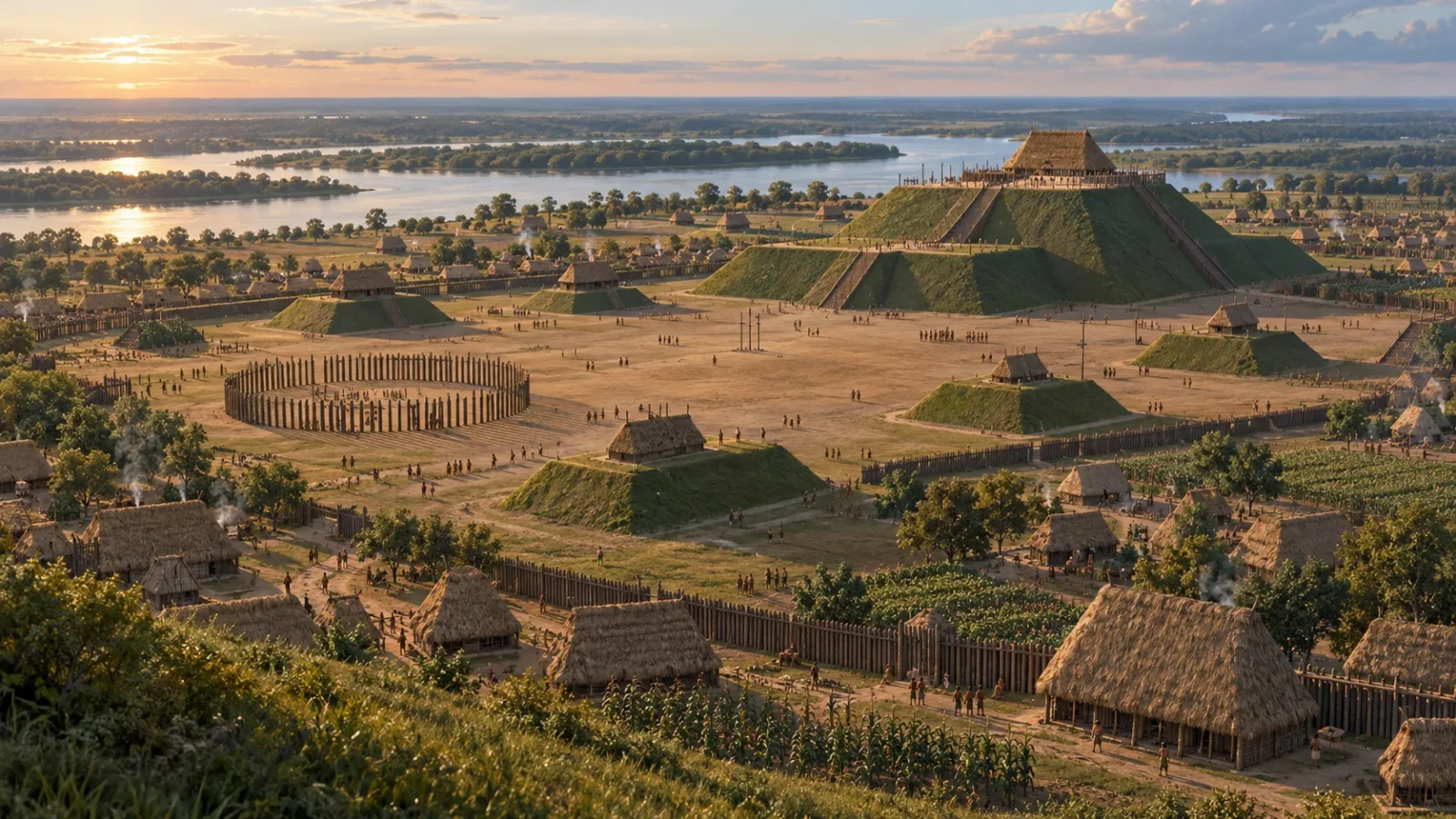
Across the flat Illinois landscape, the mounds at Cahokia rise like landmarks on a horizon. They look quiet now. A thousand years ago, they stood among houses, broad plazas, timber circles and crowded routes beside the Mississippi River.
Cahokia was the largest known urban centre north of Mexico in its era. It grew from about AD 1050 and flourished for several centuries, drawing people into a settlement whose influence reached far beyond the mounds that survive today. Archaeologists can map its scale and changing layout. They cannot recover every name, ceremony or reason people chose to leave.
A city made from earth and timber
The site lies in present-day Illinois, across the river from St. Louis. UNESCO describes its main occupation as spanning roughly AD 800 to 1350, though Cahokia’s greatest growth came later, during the Mississippian period. The historic landscape covers about 1,600 hectares.
Keep exploring
Continue with Curiosmos
People built around 120 mounds here. Some were later damaged or levelled; the largest, Monks Mound, still rises about 30 metres above the plain. It was raised in stages, with successive layers of earth carried and packed by hand. A broad platform on top once supported buildings made of wood and other materials that have long since decayed.
The Grand Plaza opened a large space beside the central mounds. Residential districts spread outward. A timber palisade enclosed parts of the centre, and its rebuilding left traces that archaeologists can follow. This was a city whose walls and public architecture were mostly alive only as soil patterns, postholes and changes in the ground.
Population estimates vary. The central settlement may have held between 10,000 and 20,000 people at its height, with many more living across the surrounding region. Those figures describe a peak inferred from house remains and settlement patterns; Cahokia’s population changed over time, and no excavation can produce a census.
What the mounds made possible
Monks Mound dominated the centre, but its size is only part of the story. Its raised summit, the open plaza and the routes between them shaped how people approached and gathered. The arrangement turned movement through the city into a visible public experience.
Archaeologists have found evidence of buildings and repeated rebuilding on the mound. That tells us the platform mattered enough to maintain and alter. It does not identify everyone who used it or specify what happened there. Those details have to be inferred cautiously from the buildings, objects and wider setting.
Near the mounds, a series of timber circles became known as Woodhenge. Their posts marked positions across the landscape, and some alignments correspond with sunrise points at particular times of year. The circles were rebuilt in different forms. They may have helped people follow seasonal cycles, but a line of posts cannot tell us exactly how Cahokia’s residents understood the sky.
Earth, timber and the horizon worked together. Mounds gave the city a vertical centre; plazas left room for people to assemble; the timber circles connected built space with the changing light. It is a compelling design, even when its precise meanings remain beyond reach.
Finding streets beneath a grassy field
The visible monuments are only a fraction of Cahokia. To trace houses, palisades and earlier layouts, archaeologists combine excavation with aerial photographs and geophysical surveys. Magnetometry and electromagnetic induction can detect buried features by measuring subtle differences in soil and magnetic response.
These tools do not produce a photograph of the past. They reveal patterns that researchers interpret, then test with targeted excavations. A patch of disturbed soil might be a house, a pit or a later change in the ground. Used together, survey and excavation let archaeologists investigate large areas without digging them all up.
The Illinois State Archaeological Survey has used electromagnetic mapping to examine places where little is visible at the surface. That work helps show how much of Cahokia’s story lies beyond the mounds: homes, open spaces and successive changes to the city plan.
A long transformation, not a single collapse
Cahokia’s central settlement changed over centuries. The palisade was rebuilt; districts shifted; people moved through a region connected by trade and kinship. By the later 1300s, the urban centre had largely dispersed.
Researchers have considered many possible pressures, including flooding, climate variability, conflict, political change and the demands of supporting a large population. Environmental records can identify periods that affected farming, but they cannot on their own explain what people decided to do. One dry spell or flood should not be mistaken for a complete answer.
Nor did everyone vanish from the Mississippi Valley. Communities continued across the region, carrying and changing Mississippian traditions in new places. The end of Cahokia as a dense centre is not the same as the end of its people.
What remains is an extraordinary record of urban life built from materials that rarely survive. The mounds show where labour accumulated. Geophysical maps trace houses below the grass. Together they reveal a city planned and replanned by generations, even as the words its residents used for their home are lost.
Cahokia also sits within a wider human story of building with earth and stone. Curiosmos has looked at why ancient communities raised megalithic monuments; Cahokia offers a different answer in material, but the same reminder that landscapes can be deliberately remade.