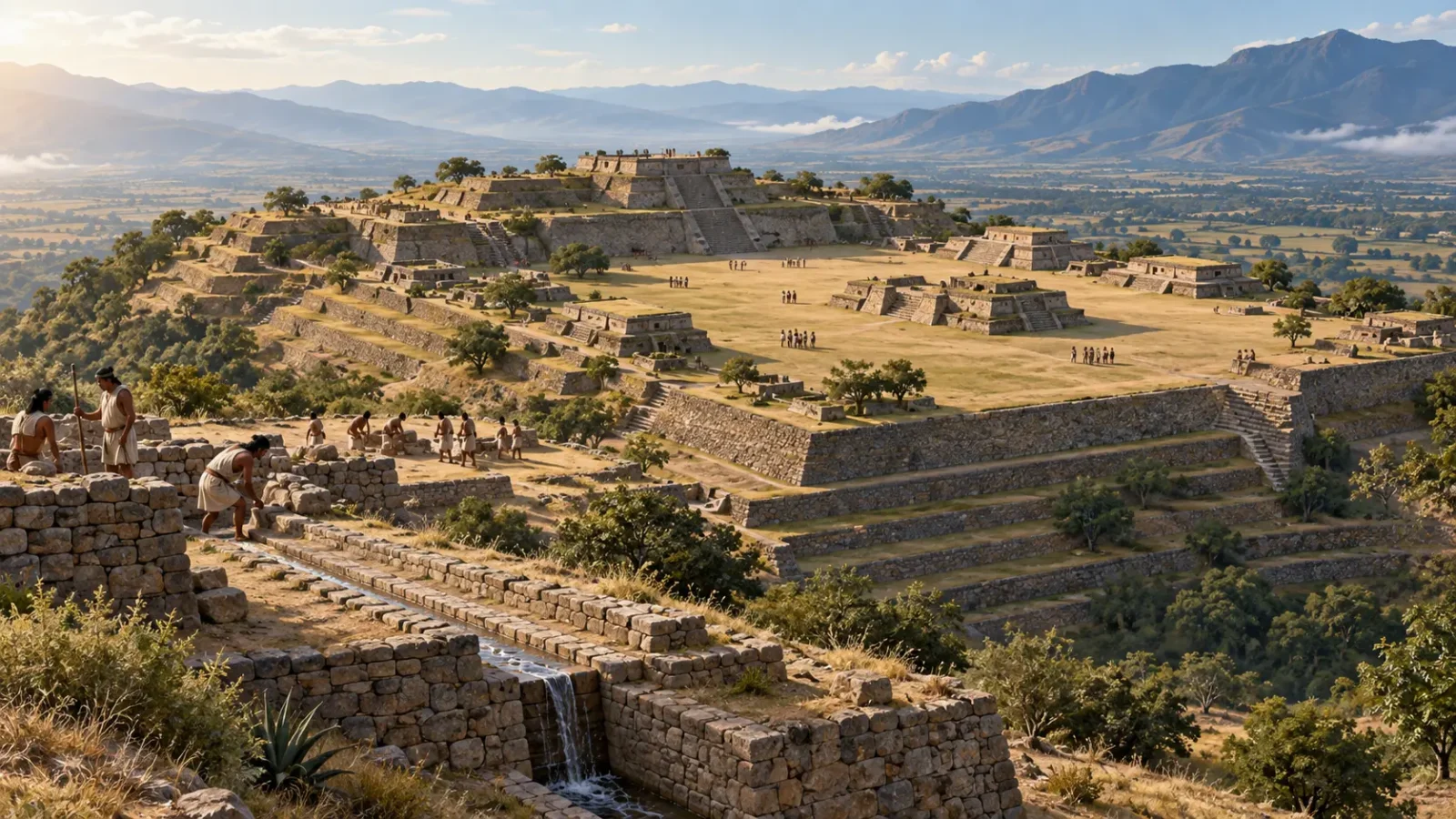
Monte Albán sits high above Oaxaca’s central valleys. Its builders cut terraces into the slopes, levelled a broad summit and carried water across the hilltop. The result was a capital laid out on ground that had to be made before the city could rise.
For about 1,500 years, Zapotec communities used the site as a ceremonial and administrative centre. Later Mixtec groups returned to parts of it. The flattened summit is a record of both engineering and power: people reshaped the mountain, then gathered around the plaza at its centre.
A city across the summit
UNESCO dates Monte Albán’s foundation to around 500 BC and describes its decline beginning around AD 850. The main plaza runs roughly north to south across the artificially levelled summit. INAH gives its dimensions as about 300 by 180 metres.
Keep exploring
Continue with Curiosmos
Platforms, palaces, tombs, a ball court and carved monuments stood around the open space. It was large enough to hold gatherings and ceremonies, while routes connected the centre with homes and settlements across the valley.
Cutting terraces into a mountain
Terraces step down the slopes where the hill would otherwise fall away. They created level ground for buildings and helped control erosion. UNESCO also records dams, canals and conduits among the works that supported the city.
Rainwater had to be directed across the summit, and people needed stable paths between buildings. The engineering shaped how residents moved through Monte Albán. A visitor approaching the plaza passed through a sequence of terraces and platforms, each with its own view of the valley.
The stone structures survive better than wooden houses and everyday objects. That imbalance can make the ceremonial centre seem more isolated than it was. Monte Albán belonged to a wider landscape of settlements, fields and secondary centres.
A capital people could see from the valley
The hilltop offered a wide view across Oaxaca and made the centre visible from a distance. Its position also gave defenders an advantage, although the site was not a fortress from its beginning. Fortifications became more prominent in later phases.
Settlement surveys show that Monte Albán stood at the top of a regional hierarchy. During the Monte Albán II period, places such as Cerro Tilcajete, Dainzú and San José Mogote served as secondary centres. The network suggests that the capital coordinated people and resources across the valley, not only religious gatherings on the summit.
Building the city required organised labour. Terraces, waterworks and large platforms altered the ground on a scale visible across the region. Anyone looking up from the valley could see where authority was centred.
Burials, ceremonies and government
Monte Albán’s public and sacred roles were intertwined. Temples and carved monuments shared the site with palaces, storage areas and administrative buildings. INAH records 249 tombs in the archaeological zone, many associated with residential units rather than isolated monumental structures.
The tombs connect household life with status and ritual. The Danzantes—carved figures on stone slabs—also carried messages into public space. Scholars have proposed different readings of the figures, but their placement shows that images and writing were part of how the city marked authority.
How the city changed
In the later Monte Albán IV and V phases, parts of the sacred centre were transformed into a fortified town. The shift reflects changing relationships in the region, though the surviving site does not identify one conflict as the cause.
Monte Albán’s political decline began around AD 800–850. People did not necessarily stop visiting at once. Buildings could lose their administrative role while families continued to bury the dead or reuse the summit. The later Mixtec presence belongs to the continuing history of the place.
Across fifteen centuries, communities inherited and altered a mountain already shaped into a capital. Monte Albán’s terraces still show the first demand its founders faced: before they could build a city on the summit, they had to build the summit itself.
For a look at other ancient Mesoamerican centres, see Curiosmos’ overview of lesser-known Mesoamerican civilizations and our report on mica recovered at Teotihuacan.
Sources and further reading
- UNESCO World Heritage Centre: Historic Centre of Oaxaca and Archaeological Site of Monte Albán.
- Instituto Nacional de Antropología e Historia: Monte Albán.
- INAH: The Tombs of Monte Albán.
- Christina M. Elson, “Cerro Tilcajete: un centro secundario del Estado zapoteco temprano”.
- Blanton et al., “Territorial expansion and primary state formation”.