Deep within a modest cavern near Paris, researchers believe they’ve uncovered humanity’s earliest attempt at a 3D map. The ancient carvings, etched roughly 20,000 years ago by hunter-gatherers, depict what could be a miniature version of the surrounding landscape, according to geoscientists Médard Thiry and Anthony Milnes.
Their study reveals how early humans may have used these carvings to represent valleys, rivers, and hills, with water trickling through carefully designed grooves to mimic natural waterways. This discovery sheds light on our ancestors’ ability to think abstractly and interpret the world around them in ways previously underestimated.
A Carved Landscape Hidden in Stone
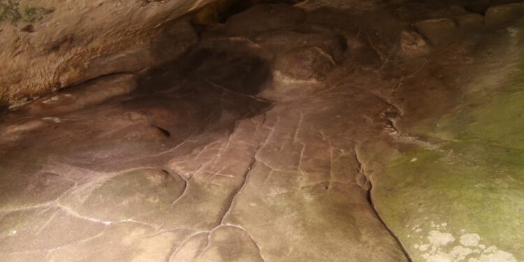
The cave, known as Ségognole 3, is part of a sandstone network featuring thousands of Stone Age engravings. However, this site stands out, dating back to the Upper Paleolithic period, when human communities were just beginning to emerge. Unlike most art from that era, Ségognole 3 offers both animal engravings and what could be a functional topographical representation.
Thiry and Milnes argue that these carvings are more than random markings. The grooves and basins match features of the nearby École River valley, suggesting a purposeful attempt to map the terrain. “The precision in the hydrographical network design is evidence of sophisticated abstract thinking,” the researchers note.

An Ancient Water System at Work
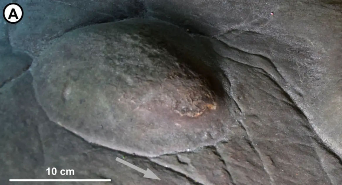
During rainfall, water seeps through fractures in the cave walls, flowing into basins and channels on the cavern floor. The largest basin, likely deepened by human hands, acts as a reservoir, feeding water into other parts of the cave. Downstream, the water splits into paths, one flowing through a triangular groove resembling a pelvis, while another winds through what appears to be a scaled model of the valley.
Rounded mounds, encircled by deep grooves, resemble hills and ridges. The furrows’ winding paths mimic rivers, converging into delta-like formations. Combined with the absence of repetitive patterns, this intricate layout points to a deliberate representation of the landscape’s natural features.
Interpreting the Purpose of Prehistoric Cartography
While earlier engravings may also be interpreted as maps, they typically reflect hunting grounds or settlements rather than a complete natural terrain. Thiry and Milnes emphasize caution in drawing conclusions but suggest the map may have served multiple purposes. It could have been a tool for hunting strategies, a teaching aid, or part of rituals involving water and the surrounding environment.
If confirmed, this discovery provides a glimpse into the intellectual capabilities of our ancestors and their ability to translate complex landscapes into tangible representations, bridging the gap between survival and creativity.


