Spacecraft near the Moon cannot simply open a map app and ask where they are. For decades, missions have relied on ground stations to measure their position, calculate a trajectory and send instructions back across space. NASA is now testing a different idea: use the navigation signals already beamed around Earth, even when a spacecraft is far beyond the planet. It is a practical test of what GPS on the Moon could mean for future missions.
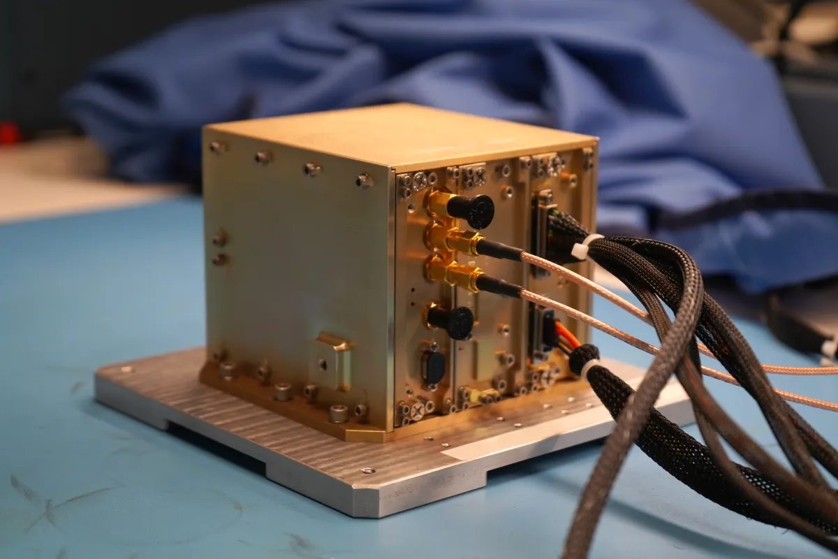
On July 13, NASA delivered a small flight unit called NavCube3-mini to Intuitive Machines. The receiver will be integrated into the company’s Altus-1 lunar relay satellite. If the mission performs as planned, the hardware will help demonstrate GPS- and Galileo-style navigation at lunar distances, where those signals are faint and arrive from behind the spacecraft rather than from a local constellation.
Why GPS does not stop at the edge of Earth
Navigation satellites are designed to broadcast toward Earth, not toward the Moon. Their signals therefore weaken rapidly with distance. A spacecraft beyond low-Earth orbit is not sitting inside the main beam, but some of the transmissions still spill outward. Sensitive receivers can detect that leakage, compare signals from multiple satellites and estimate a position.
The technique is known as high-altitude or space-based GNSS navigation. It has already been tested in Earth orbit. The lunar environment is more demanding: the receiver must handle a much weaker signal, a greater light-travel distance and periods when the Moon blocks the spacecraft’s view of Earth.
A receiver small enough for a relay satellite
NavCube3-mini is about half the size of a shoebox, weighs roughly 3.5 pounds and is designed to operate on less than 20 watts. Those figures sound modest, but mass and power are precious on a lunar spacecraft. A navigation system that needs a large dish or constant assistance from Earth would compete with the relay’s main communications work.
Altus-1 is intended to help pass data between the lunar surface and Earth. Adding an experimental navigation receiver gives the satellite a second job: it becomes a test bed for systems that future lunar spacecraft could use to determine their position more independently.
How the experiment could change lunar missions
Today, ground teams often build a spacecraft’s position from a chain of measurements. The process is reliable, but it can take time and it uses valuable communications links. A receiver that can produce a useful position estimate on board would give flight computers another source of information.
That capability could help a relay satellite maintain its orbit, support a lander’s navigation or coordinate several spacecraft moving through cislunar space. It would not replace ground tracking overnight. Instead, it could provide an additional check when a spacecraft is between ground contacts or when several missions need to share the same communications network.
NASA is particularly interested in the lunar south pole, where terrain and long shadows make the environment difficult to map and where future Artemis activity is planned. A navigation system that works with less continuous support from Earth could make operations more flexible in that region.
The hard part is the signal
Detecting a navigation signal at lunar distance is not the same as receiving a strong signal on Earth. The spacecraft has to distinguish a faint transmission from background noise, account for the movement of both the navigation satellite and the receiver, and combine signals that may arrive at very different strengths.
There is also a geometry problem. A receiver near the Moon may see only a small portion of the navigation-satellite constellation, and the signals may come from directions that produce a poor position fix. Engineers will compare the receiver’s results with conventional tracking to learn when GNSS can be trusted and when another method must take over.
Navigation as infrastructure for the next lunar era
Moon missions are often described through their headline destinations: a crater, a landing site or a scientific instrument. The less visible systems can determine whether those missions work. Communications relays, timing references and navigation sensors form the infrastructure that lets spacecraft operate as a network.
Curiosmos has followed the effort to build new space hardware, including NASA’s antenna tests for a future Mars aircraft. The destinations are different, but the engineering lesson is similar: a mission’s range depends on the small systems that keep its instruments pointed, its data moving and its location known.
NavCube3-mini will not turn the Moon into an extension of Earth’s satnav coverage. It is a carefully bounded demonstration. But if the receiver can produce dependable fixes in lunar orbit, it would give mission planners one more tool for building a permanent, busier space around the Moon.