At Oued Beht in Morocco, archaeologists have dated a ditch and rampart to roughly 3,500–4,000 years ago. What was this carefully placed barrier protecting?
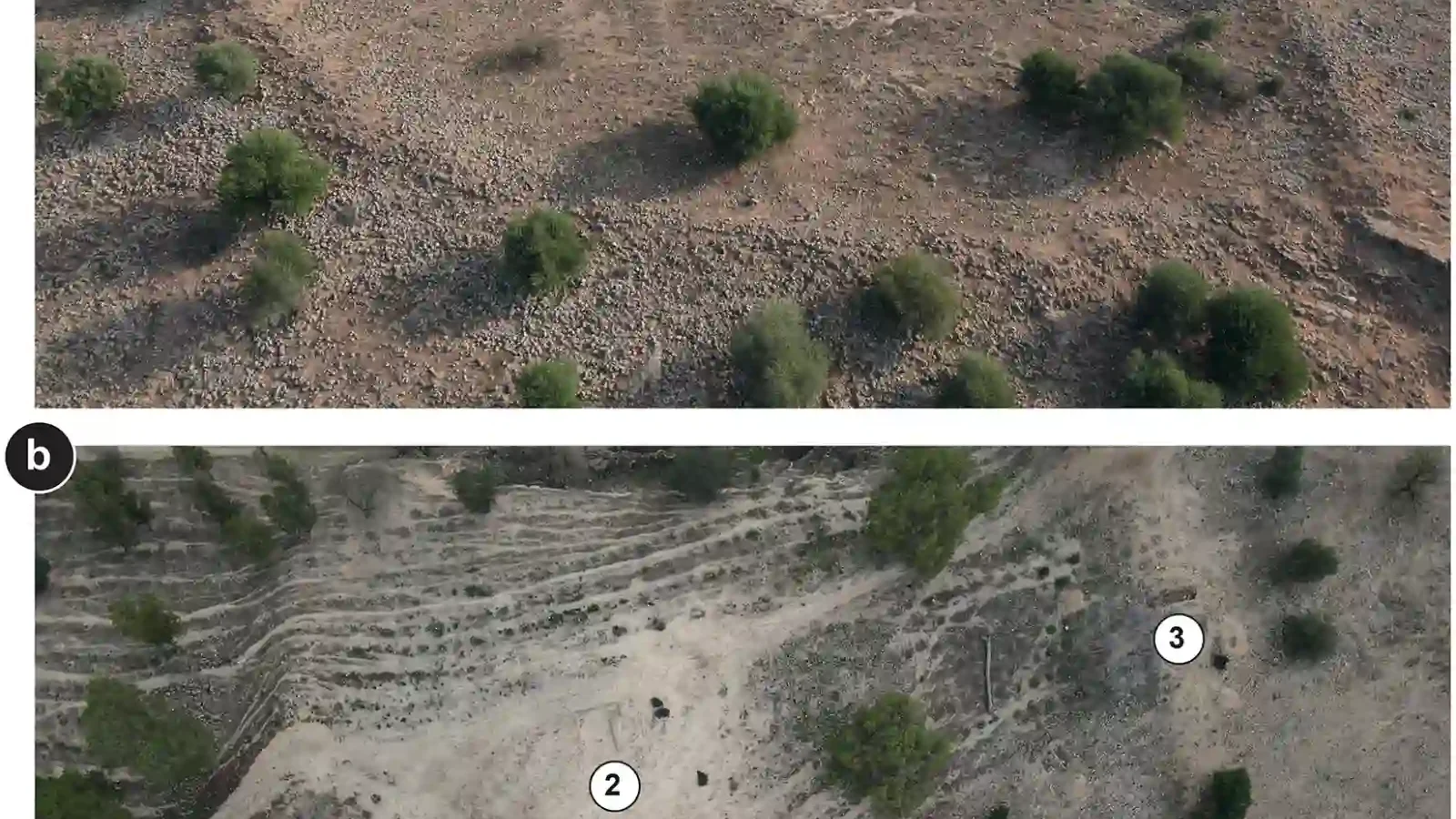
A ridge in northwestern Morocco looks across a river, a road and a patchwork of fields. From the ground, it is easy to read the landscape as an ordinary hill. From above, the shape becomes harder to ignore: a narrow southern spur is cut off by a broad defensive system, later covered and strengthened by a medieval stone wall.
New excavations at Oued Beht have now given that older earthwork a date. Seventeen radiocarbon measurements place its first construction between the beginning and middle of the second millennium BC, about 3,500 to 4,000 years ago. That makes it the oldest defensive structure so far identified in North Africa beyond the Nile Valley.
Keep exploring
Continue with Curiosmos
A settlement with a much older story
Oued Beht was already unusual before the new discovery. Earlier work by the Oued Beht Archaeological Project identified a settlement spread across roughly 9–10 hectares. Its main phase, dating from the mid-fourth to the early third millennium BC, belonged to a farming community that cultivated crops, kept livestock and produced large quantities of pottery and stone tools.
That earlier community left a dense archaeological footprint. The excavations found storage pits, plant remains, animal bones, polished axes and grinding stones. The location also appears to have been connected to wider western Mediterranean networks: some of its material culture has parallels across the water in southern Iberia.
For decades, however, archaeologists could not say when the large linear features at the southern end of the ridge had been built. They were visible, but the most obvious masonry was not enough to establish whether the whole complex was prehistoric, medieval or a mixture of both.
What the new excavation found beneath the wall
The answer came from looking below the later stonework. Beneath the medieval masonry, the team identified a substantial ditch and an embankment that blocked the southern end of the settlement. The natural shape of the ridge did much of the work: the system crossed a narrow approach between a river and a ravine, turning the rocky spur into a more defensible place.
The radiocarbon dates do not come from the wall itself. They date deposits associated with the construction sequence, including phases of building, repair and destruction. That distinction matters. Archaeologists can now place the earthwork in the second millennium BC, while the visible stone wall belongs to a much later period of reuse.
The result is a layered landscape rather than a single fortress frozen in time. A prehistoric community changed the shape of the ridge, medieval residents returned to it, and each group left a different kind of mark.
Was it built to keep people out?
“Defensive” is a useful description of the structure’s design, but it does not tell us exactly what danger its builders imagined. The ditch and rampart could have helped repel an attack. They might also have controlled movement through the ridge, protected access to resources or marked a boundary between communities.
The excavators are careful about that uncertainty. There is no evidence in the new study that identifies a specific enemy or records a battle. What the structure does show is a decision to concentrate labour on a strategic point. People altered the ground, restricted an approach and maintained the work over time.
Could competition over land and water have been enough? That is one possibility. The site sits in a productive landscape, and the wider Oued Beht community was already investing in storage, farming and craft production. As populations, exchange networks or local leadership changed, controlling a ridge may have become as important as cultivating the fields around it.
A North African comparison with Iberia
The date also places Oued Beht in a wider Mediterranean conversation. During the second millennium BC, communities of the El Argar culture in southern Iberia were living in fortified settlements, working metal and organising people on a larger scale. The parallel does not prove that the two regions shared a single defensive plan, but it raises a better question than the old image of an isolated Maghreb.
What if communities on opposite shores were responding to similar pressures—competition for land, control of routes and the need to organise collective labour—while developing their own solutions? The evidence from Oued Beht cannot answer that by itself. It does, however, place northwestern Morocco inside a story of connected change rather than at its edge.
Curiosmos has previously examined how ancient communities managed water and movement, including the 3,000-year-old aqueducts identified with Cold War satellite imagery and the Copper Age fortress of Los Millares. Oued Beht adds a different kind of evidence: a defensive landscape whose earliest phase survives mainly as earth, slope and soil.
The ridge was used again centuries later
The site’s story did not end when the prehistoric settlement changed. A medieval stone wall was built above the older earthwork, and a cemetery from the same broad period was found nearby. The researchers place much of this later activity between the eleventh and thirteenth centuries AD, when rural communities across the western Maghreb were expanding and reorganising their landscapes.
That long sequence is one reason Oued Beht matters. The ridge was not selected once and forgotten. Different communities returned to the same topography because it offered something valuable: a commanding position, a defensible approach and access to a landscape already shaped by earlier people.
The next questions are practical ones. How far did the prehistoric community extend beyond the excavated ridge? Did the ditch and rampart enclose homes, storage areas or a place where people gathered during danger? And how did the work relate to the farming settlement that flourished there centuries earlier?
The answers will come from more excavation, more dates and the careful study of what was found inside the earthwork. For now, Oued Beht gives North Africa a rare and substantial defensive horizon—and gives archaeologists a new way to ask how communities organised themselves long before written histories described them.