NASA’s Curiosity rover has climbed onto a feature in Gale Crater that may mark a pause—and a change—in the story written by Martian rocks. The mission team calls it a possible erosional “supersurface,” a boundary where an environment that was building layers switched to one that was removing them before deposition began again.
On Earth, a surface like this can form when wind, water or a change in climate strips material away from an older landscape. On Mars, the boundary is valuable because it separates two parts of the sedimentary record. Curiosity is now close enough to examine the rocks on both sides rather than relying only on distant images.
A break in the rock record
Gale Crater contains Mount Sharp, a layered mountain rising from the crater floor. Curiosity has spent years climbing its lower slopes, reading the exposed layers as a sequence of changing environments. Each bed of rock carries clues about the conditions that existed when its sediment settled.
The suspected supersurface represents a different kind of evidence. It is not a single layer deposited in one event. It is a gap: a period when erosion outpaced deposition. The missing time cannot be read directly, but the surfaces above and below can preserve traces of the conditions that came before and after it.
Mission scientists have seen features that may have formed in wind and others that could be consistent with flowing water. Those interpretations are still being tested. Curiosity’s latest work is designed to improve the evidence, not to declare a final climate history from one photograph.
Curiosity takes the steep route
During the latest planning cycle, the rover approached a vertical exposure called Cerro Paine Grande. Mastcam recorded stereo mosaics of the face and a wide panorama after Curiosity reached the top of the suspected boundary. The final parking position left the rover tilted by roughly 24 degrees, close to the mission’s contact-science limit.
That angle matters because Curiosity’s instruments need a stable working position. The rover’s robotic arm must place the Mars Hand Lens Imager, or MAHLI, close to the target while the Alpha Particle X-ray Spectrometer and the Chemistry and Camera suite examine the rock’s composition and texture.
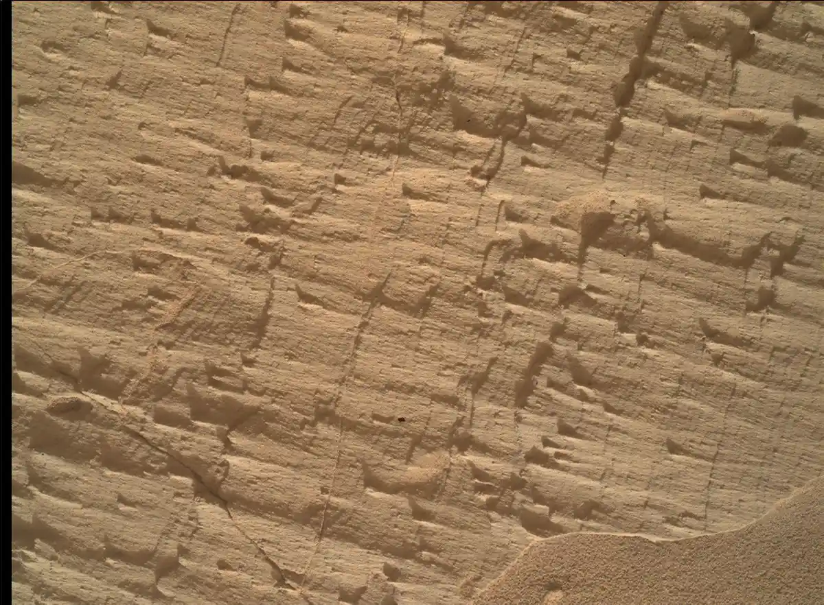
One workspace, named Longquimay, provided a close look at fine sedimentary structures. Other targets were examined with the rover’s laser, which can vaporize a tiny patch of rock and read the resulting plasma. Together, those instruments help the team compare the light-toned surface with the darker laminated material beneath it.
What the layers may reveal
Layered rocks are records of movement. Fine, repeated textures can point to wind-blown sand. Lens-shaped deposits may form in flowing water, although their interpretation depends on the surrounding geometry and chemistry. A single clue is rarely enough. Curiosity’s strength is that it can examine the same outcrop with several instruments and connect the close-up measurements to the larger landscape.
If the boundary formed when the climate or surface environment changed, the chemistry above and below it may differ. The thickness and angle of the beds can also show whether material was carried by wind, water or a combination of both. Over time, those observations can turn a vague line in a photograph into a more precise account of what Mars was doing.
This is the kind of work that makes rover science look slow from Earth. Curiosity may spend days approaching a slope, then weeks testing a handful of rocks. The pace is deliberate because every target must be selected from images taken millions of kilometres away, and because the rover cannot repair a damaged instrument by hand.
The wider question: how long did Mars stay habitable?
Curiosity is not trying to prove that life existed in Gale Crater. Its job is to reconstruct the ancient environments that might have supported habitable conditions. The supersurface could help define how long water or wet sedimentary processes remained active before erosion took over.
That question connects with the mission’s earlier discoveries of ancient lake deposits and organic molecules. It also connects with NASA’s wider Mars programme, including tests of communication systems for future aircraft on Mars. Different missions address different pieces of the problem: what Mars was like, how it changed and how future explorers can work there.
Curiosity’s climb will not settle the planet’s climate history on its own. It does give researchers a new place to compare the layers on either side of a missing interval. In a world where wind and water may have repeatedly erased the evidence, that boundary is not an empty space. It is a record of change.