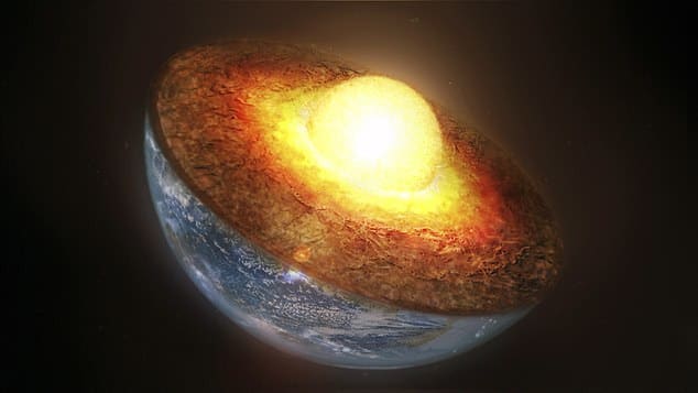
There may be mountains beneath Earth’s surface that dwarf Everest — and they’ve been hiding 660 kilometers below the surface this whole time. Buried far below the crust, these jagged peaks are invisible to the eye, unreachable by any drill, and yet massive enough to reshape how we think about the planet’s interior.
This buried world is so massive and complex that it’s challenging everything we thought we knew about Earth’s inner structure.
The key to this discovery lies in the study of seismic waves — vibrations that ripple through the planet after major earthquakes. In 1994, an 8.2 magnitude earthquake rocked Bolivia. Though it happened decades ago, its aftershocks are still being felt — scientifically.
Researchers from Princeton University and the Chinese Academy of Sciences used data from that quake to probe deep into the Earth using seismic imaging. Like sonar, this method tracks how seismic waves reflect and refract as they pass through different materials and boundaries underground.


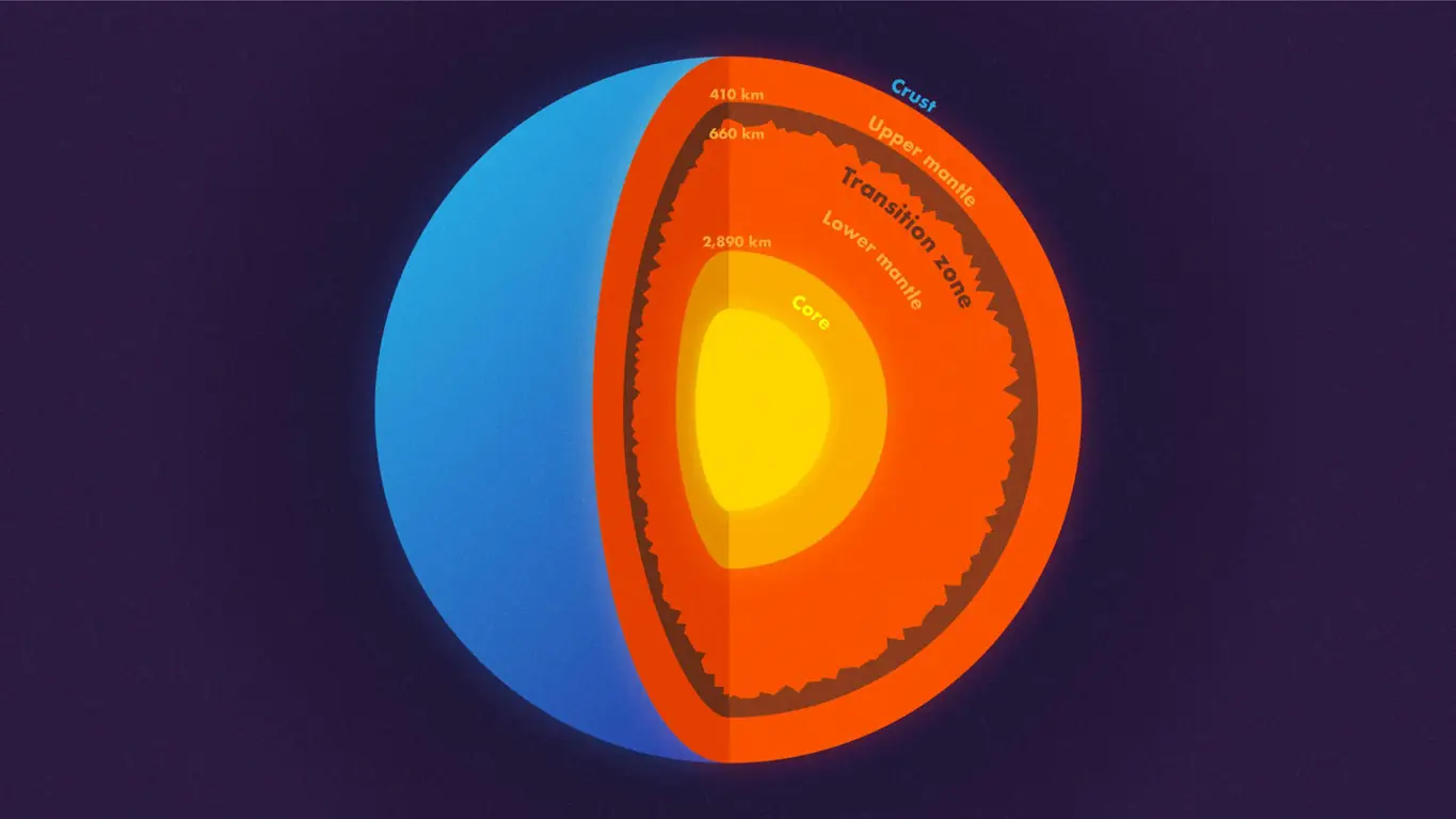
They focused on a mysterious boundary layer 660 kilometers below the surface — a divide between Earth’s upper and lower mantle. What they found there was astonishing: not a smooth interface, but a jagged, mountainous terrain with elevation differences that could rival the Rocky Mountains — or even Mount Everest. In short, they uncovered the first evidence of true mountains beneath Earth’s surface.
The rough terrain of mountains beneath Earth’s surface
The researchers didn’t directly “see” these mountains — instead, they studied how seismic waves scattered and bounced at the boundary. Their findings revealed extreme topography. In fact, this deep layer may be rougher than any terrain we walk on above ground.
They discovered a landscape that alternates between smooth, flat plains and chaotic, jagged peaks. And much like Earth’s crust, this subterranean world may be shaped by ancient geological processes — ones that continue to echo in the structure of the mantle. These mountains beneath Earth’s surface are not random — they’re fossils of a dynamic planet in motion.
One of the most intriguing theories is that this deep roughness is caused by sunken tectonic plates — slabs of oceanic crust that were once on the surface, but over millions of years were forced down into the mantle at subduction zones.
These crustal fragments may have stalled at the 660-kilometer mark, building up and warping the boundary into a buried mountain range. Their presence could also explain chemical differences between the upper and lower mantle — supporting the idea that they don’t always mix completely.
This offers a potential resolution to a long-standing geological debate. Some scientists argue that the mantle behaves as a single, well-mixed system, while others claim it consists of chemically distinct layers.
The data now suggests: both could be right. In some places, the mantle is blended. In others, it’s sharply divided — a geological patchwork woven over billions of years. And the mountains beneath Earth’s surface might hold the keys to that timeline.
These rough zones may also preserve ancient geochemical signatures, helping scientists understand not just the structure, but also the history of Earth’s interior.
She added that discoveries like this allow scientists to map the evolution of Earth’s interior across time — not just space.
As seismic instruments become more advanced and global networks expand, scientists are gaining the ability to detect increasingly subtle features. This opens the door to an entirely new kind of geology — one that takes place hundreds of kilometers below the crust, deep among the mountains beneath Earth’s surface.
What it means for the future of Earth science
Understanding what lies at the 660-kilometer boundary could change the way we view key planetary systems — from volcanic activity and tectonic movement to heat transfer from the core to the crust.
It may also provide crucial insights into where recycled crust ends up, and how long it remains in the mantle before it resurfaces — or whether it ever resurfaces at all.
And as Wu pointed out, this is just the beginning. Their team’s work focused primarily on the 660-km boundary. But what lies deeper, closer to the core? What hidden landscapes still remain undetected?
These buried mountains won’t appear on any map. No climber will scale them. No drone will ever fly above their peaks. But that doesn’t make them less real — or less important.
In fact, these invisible giants may hold the key to understanding how Earth formed, how it evolved, and how it continues to operate from the inside out.
And just like Verne imagined in Journey to the Center of the Earth, there really may be a world hidden beneath our feet — one we’re only just beginning to uncover.