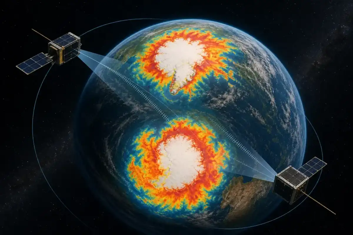
Earth’s poles are constantly shedding heat into space, but much of that energy is invisible to human eyes. NASA’s twin PREFIRE CubeSats are measuring that far-infrared loss directly, and the first full seasonal cycles show why the Arctic and Antarctic cannot be treated as mirror images.
This is not simply a new visualisation of polar weather. It is a better measurement of Earth’s energy budget, the balance climate models need to track how heat moves from the tropics and leaves the planet. The result connects to Curiosmos coverage of solar-storm risk and Antarctica’s ice history.
The Polar Radiant Energy in the Far-InfraRed Experiment began collecting science data in July 2024. The twin satellites now provide a record of the annual temperature swing at both ends of the planet, offering a closer look at a part of Earth’s energy budget that has been difficult to measure on a global scale.
NASA estimates that far-infrared wavelengths carry close to three-fifths of the heat Earth sends away. Water vapour, clouds, ice and snow all affect how that energy moves through the atmosphere. Measuring the signal from the surface and lower atmosphere helps scientists test whether climate models are getting those exchanges right.
The Arctic and Antarctic do not behave the same way
The two poles experience opposite seasons. When the Arctic is in summer, Antarctica is in winter, and the amount of sunlight each region receives changes dramatically. The Arctic also has a large ocean covered by sea ice, while Antarctica is a high continent surrounded by ocean. Those differences shape the timing and size of the temperature swings seen in the PREFIRE animation.
In the Arctic, summer warmth can thaw tundra and open stretches of sea ice before darkness returns. Antarctica remains colder overall, and much of its interior stays below freezing even during the summer season. The measurements capture those contrasts without relying only on surface weather stations.
From a satellite map to a climate forecast
PREFIRE is not designed to predict tomorrow’s weather by itself. Its value is in improving the measurements used by weather and climate models. Those models need to know how much heat escapes from ice sheets, sea ice and the atmosphere, especially when clouds or water vapour change the signal.
Better observations can improve forecasts of conditions that matter far beyond the polar regions. Energy movement influences weather systems, river flows, shipping routes and the stability of ice sheets. The mission also offers an independent way to examine how rapidly changing polar landscapes affect the planet’s overall heat balance.
Two years is still a short record in climate science, but it covers the full seasonal cycle at both poles. As the satellites continue working, researchers will be able to compare years, identify unusual swings and see whether models reproduce the timing of the heat leaving Earth.
The mission’s two spacecraft do not simply take a picture of temperature. Their instruments measure the spectrum of radiation leaving the planet, including wavelengths that earlier observing systems could not see as clearly. That matters during polar night, when the surface is dark but still releasing heat. It also matters when clouds hide the surface from ordinary cameras or visible-light sensors.
Scientists can fold those measurements into the larger picture of Earth’s energy budget. If a model sends too much heat away from an ice-covered region, or too little from a cloudy atmosphere, its long-term forecast will drift. PREFIRE gives researchers another set of observations with which to find those errors. The result will not be a single dramatic number; it will be a better record of how the planet loses energy over time.
For historical context, read Curiosmos’ account of the Carrington Event and the risks posed by solar storms.