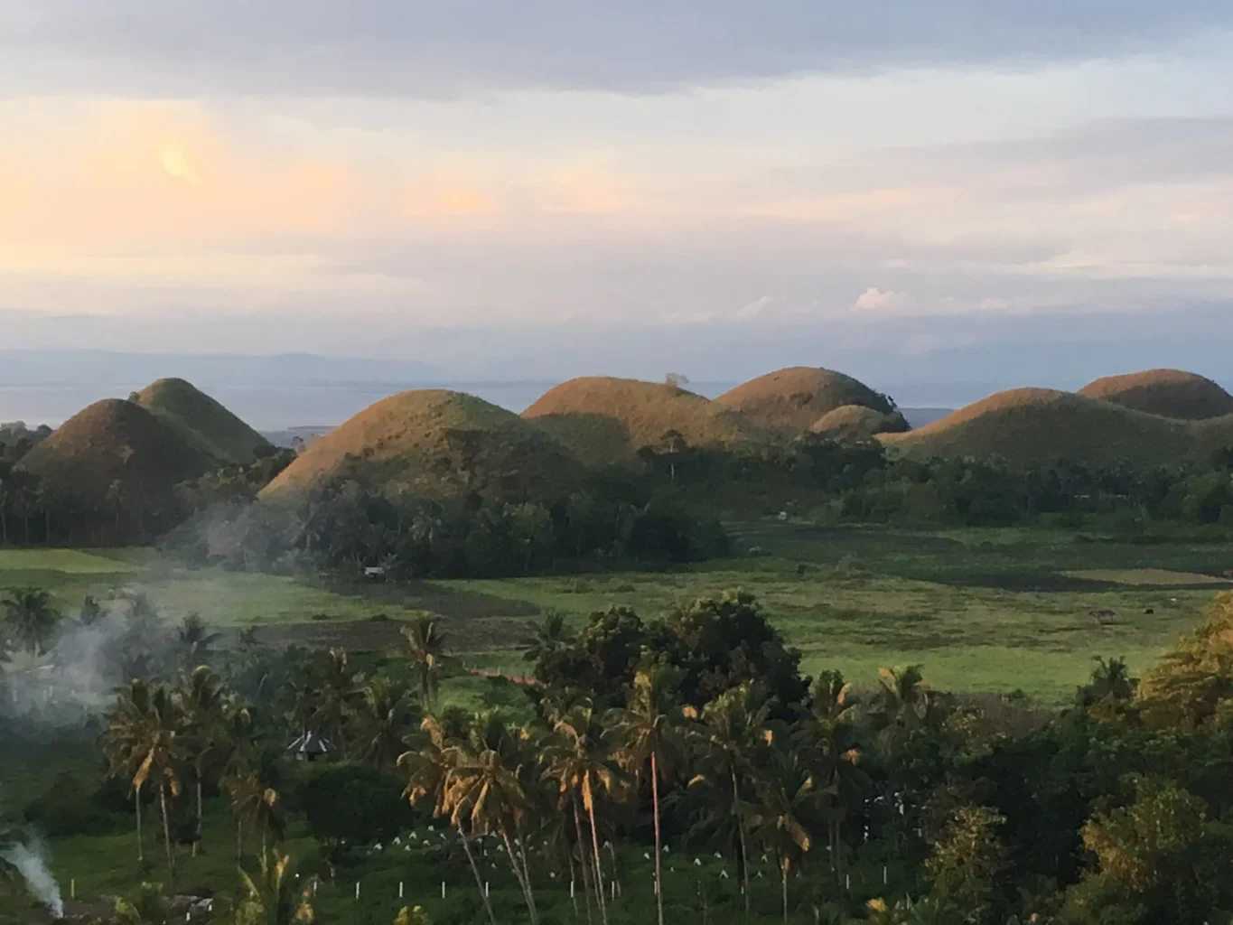
Across the centre of Bohol, rounded hills rise from the ground in such regular succession that the landscape can look arranged. During the dry season, their grassy covering turns brown. Seen from a distance, the name Chocolate Hills suddenly makes sense.
That resemblance has encouraged a different kind of explanation, too. Why should a natural landscape repeat the same shape so many times?
Stories of giants offer answers on a human scale. One tradition describes a battle that left scattered heaps behind; another tells of a giant’s grief. The geology takes us somewhere equally unexpected: beneath the sea that once occupied this ground.
The giant who wept
A Philippine tourism brochure preserved by the honorary consulate in Sofia recounts the story of Arogo, a giant whose beloved Aloya died. His tears became stone, forming the hills.
The attraction of that story is easy to understand. Repeated mounds become repeated drops, and an otherwise puzzling landscape acquires a cause someone can picture. It is a recorded version of a legend; the brochure does not establish when the tale first took shape.
The legend gives the shapes a place in local imagination. To follow how the hills themselves formed, we need to look beneath their grassy surface.
Reefs became the ground beneath the grass
UNESCO’s account of Bohol Island Geopark describes limestone derived from a thick accumulation of coral reefs during the Pliocene, approximately two to five million years ago. Uplift brought this marine material above the sea, where erosion shaped the conical hills.
There are two clocks in that description. The rock’s age concerns the formation of the material. The hill’s age concerns the much later shaping of that material into the relief we see. Calling every cone a two-million-year-old hill would blur those stages.
The island also preserves evidence that uplift can transform shorelines. The provincial geopark account describes raised coastal features produced by the 2013 earthquake. Those features do not date the Chocolate Hills, but they help make the process of a changing island less abstract.
Water works above and below the surface
Geographer Jean Noel Salomon’s 2011 study in Acta Carsologica connects the landscape with the emergence and subsequent weathering of a coral limestone platform under broadly similar tropical conditions. Rainfall, temperature, soils and vegetation all enter the explanation.
Limestone can dissolve in water containing weak acids. As water moves through cracks and porous rock, it can remove material below the surface as well as reshape the ground above it. Over time, remaining masses of limestone stand above the lowered terrain around them.
The repeating cones therefore invite a regional explanation. Similar rock and environmental conditions can produce similar outcomes across a wide area, without requiring each mound to have been formed in a separate event.
Salomon also describes aquifers that supply irrigated rice fields, together with caves and underground networks. The view from a lookout shows only part of this landscape. Water moving inside the limestone connects the apparently separate hills with the ground between them.
That relationship between visible scenery and concealed spaces also runs through our coverage of the Longyou caves. Understanding an underground space begins with asking how its rock was removed.
What the UNESCO recognition means
The Chocolate Hills appear on the Philippines’ Tentative List for World Heritage, submitted in 2006. That is a nomination-stage list, rather than an inscription as a World Heritage Site. Bohol’s UNESCO Global Geopark recognition is a separate designation.
The Philippine submission describes roughly 1,776 mounds and their seasonal change in colour. A striking photograph catches one moment in that cycle. The same slopes can look very different when the grass is green.
Visit in a different season, and the brown landscape may have turned green. The hills offer a view of rainfall, rock and vegetation working together, while the stories attached to them give the shapes a place in local imagination. Their appearance is orderly; their history reaches through a former sea, a rising island and water still travelling through the stone.