The coastline people knew may now be underwater
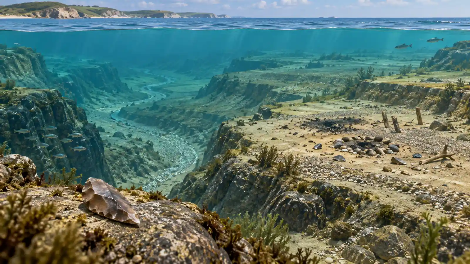
A map of the modern coast shows only the last chapter of a much longer story. During the last ice age, huge amounts of water were locked in ice. Sea levels fell, exposing plains and shorelines where people could travel, fish and build camps. When the ice melted, the water returned and covered parts of that landscape.
That raises a tantalising question: can archaeologists map the coastlines that disappeared before written history? Researchers can increasingly reconstruct them, but the map is not enough on its own. Researchers combine seafloor shape with sediments, preserved wood, artefacts and the changing chemistry of the shoreline.
Reading the shape beneath the water
Bathymetry is the underwater equivalent of topography. Sonar instruments send sound pulses toward the seafloor and measure how long the echoes take to return. By collecting many measurements, researchers can build a relief map of ridges, channels, terraces and depressions.
An ancient shoreline may leave several clues. A shallow terrace can mark a former wave-cut platform. A buried river channel can show where freshwater once crossed the exposed land. A line of dunes or a change in sediment can suggest where the sea stopped during one stage of its rise.
None of these features is automatically a human site. Nature creates patterns that look persuasive from above. Archaeologists therefore search for material evidence: stone tools, hearths, worked bone, postholes, food remains or wood preserved in low-oxygen sediment.
Why some underwater sites survive
Submerged landscapes can preserve fragile objects better than exposed ground. In oxygen-poor mud, wood and plant remains may survive long after they would have rotted on land. The same conditions can slow the activity of organisms that break down organic material.
Researchers working in the North Sea and around Denmark have found that ancient coastal environments can preserve traces of Mesolithic life beneath later sediments. These discoveries do not represent a single lost civilisation. They show that ordinary settlements once stood in places that are now difficult to reach, and that the archaeological map is shaped by sea-level change as much as by human movement. For a human example of underwater preservation, see our report on the skeleton found in a submerged Yucatán cave: the Yucatán cave skeleton.
The water also creates a selection problem. The sites we find are not necessarily the most important ones. They are the ones that survived erosion, avoided later disturbance and happened to fall within a survey area. A missing settlement may have been destroyed rather than never existed.
From a map to a human landscape
An ancient coastline was more than a line between land and water. It included marshes, tidal flats, freshwater streams, shell beds and routes between camps. People could follow a river inland, return to a fishing place each season or use a now-submerged ridge as a path.
This is where seafloor archaeology becomes more than a search for dramatic artefacts. The shape of a drowned landscape can explain why a settlement was placed in one location, why shellfish remains are concentrated in another or how groups moved between regions. Sediment cores can add a time dimension by showing when vegetation changed, when saltwater arrived and how quickly the shoreline moved.
Related reading: Curiosmos has also examined how archaeologists date ancient stone monuments and why some discoveries are left unexcavated.
Could a future survey redraw prehistory?
The next generation of offshore wind farms, cables and coastal engineering projects will expose more seafloor to detailed survey. Those projects can create opportunities for archaeology, provided the data are collected and interpreted with care.
The strongest discoveries will not come from treating every underwater shape as a mystery. They will come from combining maps with objects, dates and environmental evidence. A line on a sonar image may be a former beach, a river channel or a modern disturbance. Only the wider record can tell the difference.
Still, the possibility is extraordinary. Beneath familiar seas are landscapes where people watched different horizons, followed different rivers and lived beside a coastline that no longer exists. A better map may not reveal a lost kingdom. It may reveal something more useful: how ordinary communities adapted when the world around them changed.