A new visualization turns years of Lunar Reconnaissance Orbiter mapping into a continuous, measured view of lunar terrain.
NASA’s Scientific Visualization Studio has produced a 4K video tour of the Moon that is assembled from spacecraft measurements rather than hand-drawn imagery. The project draws on the long-running Lunar Reconnaissance Orbiter mission, which has mapped the Moon in detail since entering lunar orbit in 2009.
The video is not presented as a scientific discovery. Its value is interpretive and practical: it takes data that normally live as grids, mosaics, and elevation models and turns them into a view that lets the surface read as terrain.
A Moon you can read as terrain
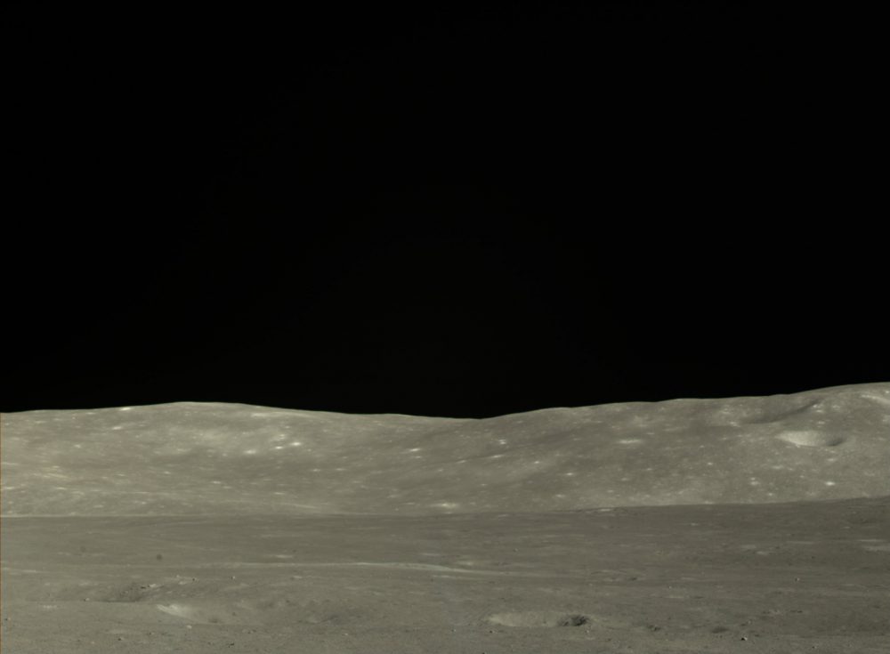
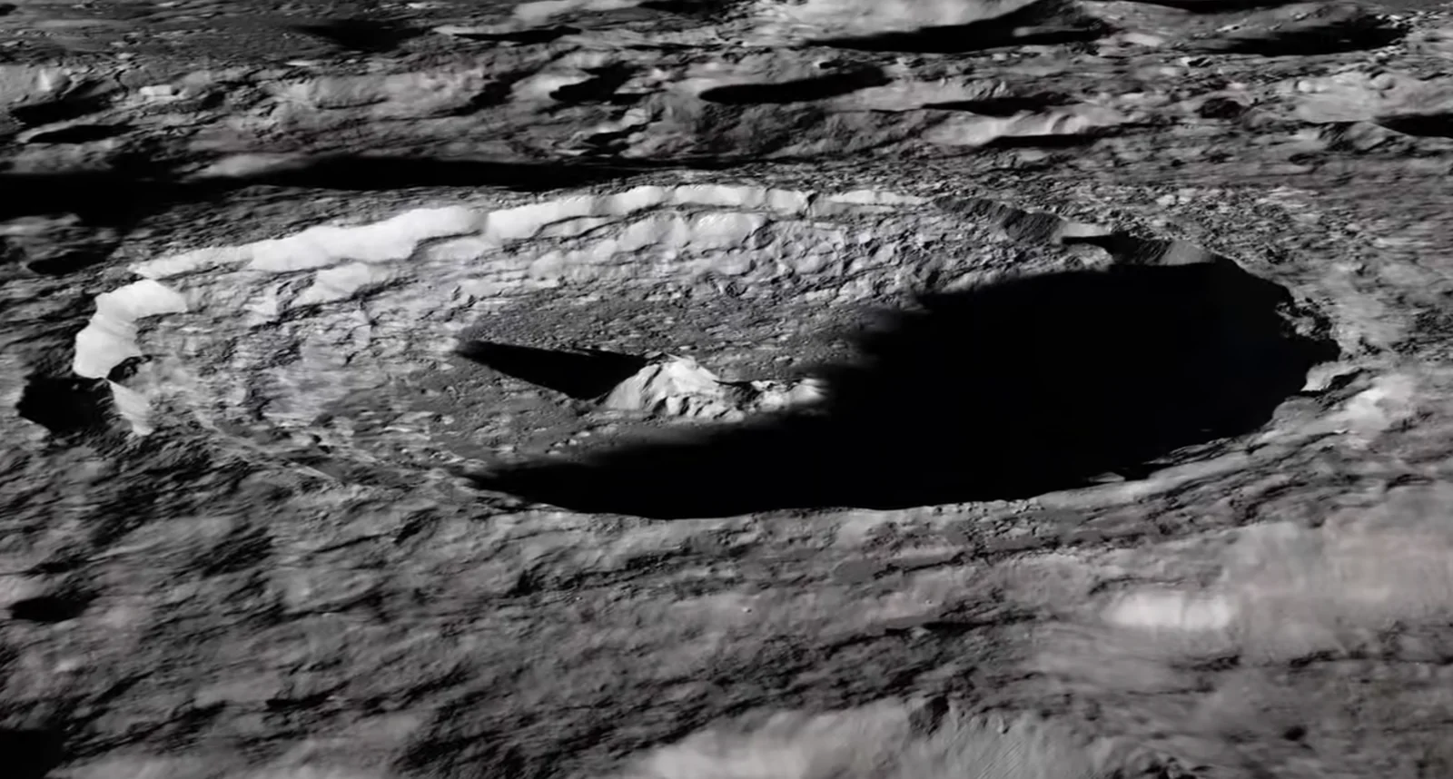
From Earth, even a good telescope compresses the Moon into a bright disk with dark plains and sharp-edged craters. The 4K tour does something different. It treats the Moon as a landscape with slopes, cliffs, ridges, and basins, where height and shadow matter as much as brightness.
The flyover moves across large impact features and the broad volcanic plains that form the dark “seas” visible to the naked eye. It also lingers on well-known craters such as Tycho and Copernicus, features that have served for centuries as reference points for observers. In the visualization, those names stop being circles on a chart and become places with rim walls, central peaks, and ejecta patterns that spread outward in recognizable rays.
The video also includes regions that do not present themselves easily from Earth. The far side, which never faces our planet, is visible only from spacecraft. Polar areas include topography that can keep some craters in deep shadow for long stretches. A tour that follows the surface makes those places legible in a way that still images often do not.
What “data-driven” means here
NASA’s phrasing matters because “not an animation” can sound like a semantic trick. The camera motion is chosen by the video makers, and the lighting is modeled. But the ground underneath is built from measurement.
The backbone is a digital terrain model derived from laser altimetry and stereo imaging, which provides the relief: what stands high, what drops low, how steep slopes are, where ridges break and crater walls collapse. The surface appearance is then draped with imaging mosaics so that albedo, crater rays, and volcanic plains match what cameras recorded.
“Real sunlight” in this context means computed illumination: the Sun angle is modeled so the video can show how light would strike mapped slopes. That is not cosmetic. On the Moon, where there is no atmosphere to soften shadows, lighting is a tool for understanding shape. A shallow ridge can disappear under overhead light and become obvious at a low Sun angle. A crater floor can read as flat until shadows reveal terraces and slump lines.

The Lunar Reconnaissance Orbiter is, in effect, the Moon’s modern survey mission. It has returned an enormous archive of images and measurements that support both science and planning. Its cameras have produced high-resolution views of the surface, and its altimetry has built a global framework for elevation, letting researchers compare regions in a consistent way.
That steady, methodical work is what makes a project like this possible. A single dramatic image can be memorable, but it cannot easily explain scale, continuity, or context. A long-running mapping mission can. The video is a translation layer between the technical archive and the way most people naturally understand a place, by moving through it.
Why NASA is emphasizing lunar geography again
A detailed, navigable picture of the Moon has become more than an educational exercise. NASA’s Artemis program is designed to return astronauts to the Moon and extend surface operations beyond short visits. Artemis I flew as an uncrewed test of the core systems. Artemis II is planned as a crewed flight around the Moon set to launch in March of 2026. Artemis III is the planned mission aimed at returning astronauts to the lunar surface in 2027, if all things go to plan.
Those missions, and other lunar efforts being developed internationally and commercially, shift the Moon from a remote object of study to a destination where terrain becomes operational. Landing sites are not just coordinates. They involve slope limits, shadow patterns, communications geometry, and surface hazards that can be invisible at low resolution.
In that sense, the 4K tour functions as a public-facing version of a serious internal need. It presents the Moon as it is actually mapped: a battered surface shaped largely by impacts, resurfaced in places by ancient lava, and preserved with unusual clarity because there is no weather to erase its history quickly. The video does not add new science on its own, but it makes the existing record easier to see, and harder to dismiss as a flat, familiar face in the sky.