The Nazca Lines stretch across the southern deserts of Peru—massive geoglyphs etched into the Earth by an ancient civilization more than 1,500 years ago. Their purpose remains unknown, their scale hard to grasp, and their mystery only deepens the more we study them. But what happens when you zoom way out? What if, instead of viewing them from a plane or satellite, you plot the Nazca Lines over the entire globe?
That’s exactly what one independent researcher did using Google Earth. And what he discovered added a whole new layer to one of the most enduring enigmas of the ancient world.
The Nazca Lines: ancient messages carved into stone
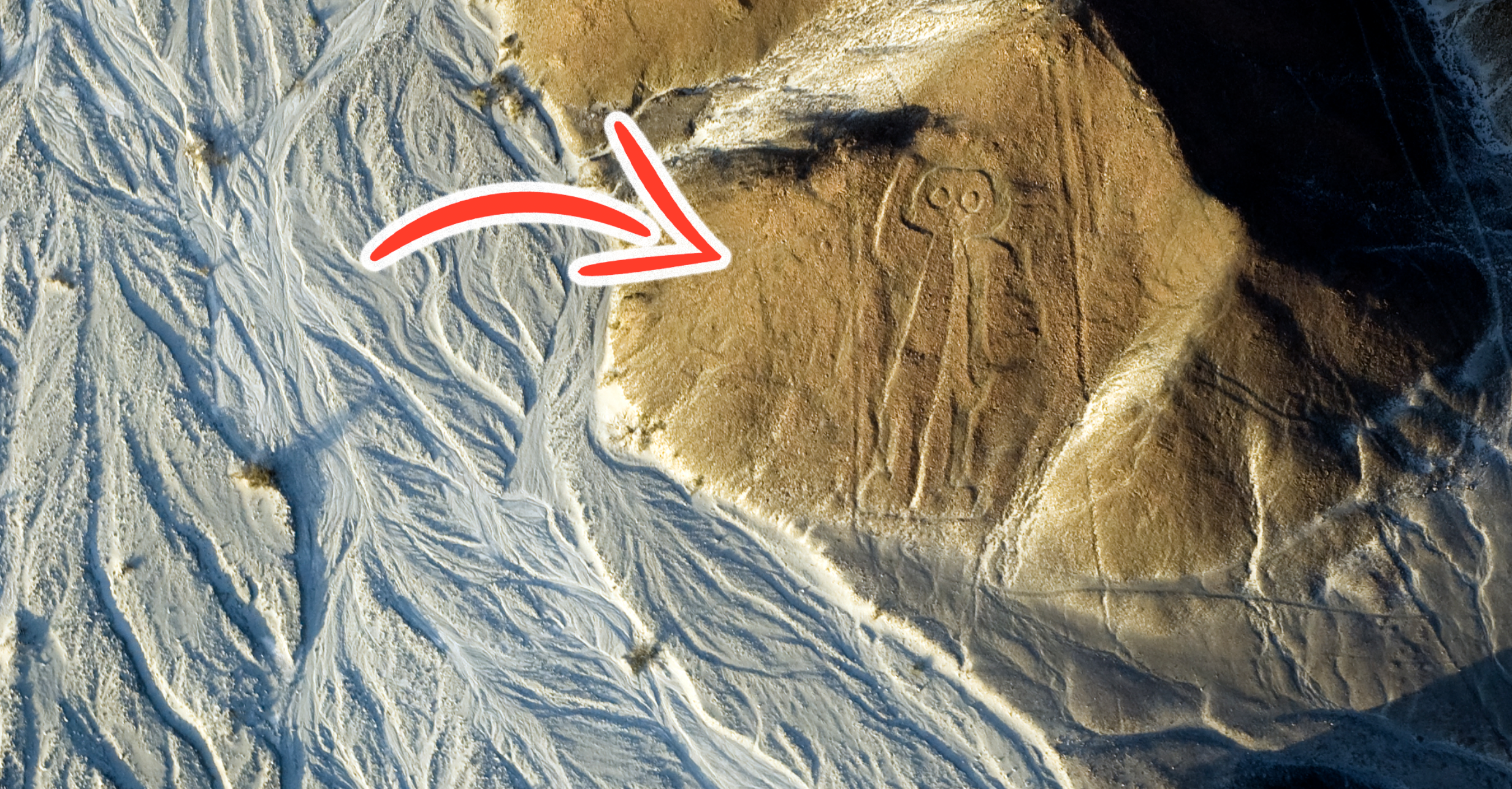
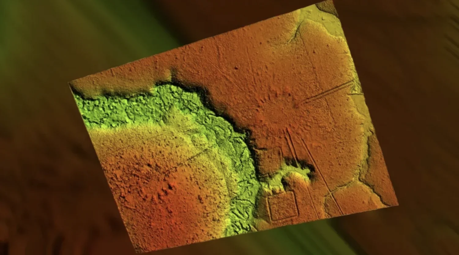
Located in southern Peru’s Nazca Desert, the geoglyphs span more than 50 square kilometers. Created by the Nazca culture sometime between 500 BCE and 500 CE, these enormous symbols include geometric patterns, animals, and humanoid figures. They were made by scraping away the top layer of iron oxide-coated pebbles to reveal the lighter-colored earth underneath.
From the ground, most of the Nazca Lines are invisible. It’s only from high above—planes, drones, or mountaintops—that the full picture comes into view. Some designs are hundreds of meters long, including one hummingbird stretching 93 meters and a monkey at 135 meters.
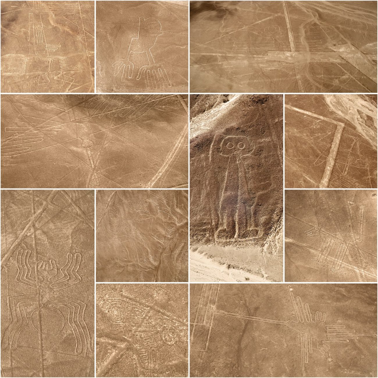
The scale is so massive that over 800 straight lines, 300 geometric shapes, and 70 animal and plant figures have been documented. Despite being just a few inches deep, the Nazca Lines have endured for centuries thanks to the region’s dry, windless, and stable climate.
What were they for? Ancient astronomy or sacred communication?
Theories about the purpose of the Nazca Lines are as vast as the lines themselves. Some researchers suggest they were made to be seen by gods in the sky. Others propose they were ritual pathways or astronomical calendars used to track solstices and equinoxes.
One theory, supported by researchers like Phyllis Pitluga of the Adler Planetarium, argues that some of the glyphs mirror celestial constellations. For example, the spider figure may align with Orion.
Another theory is that the Nazca used the lines in ceremonies to invoke water, especially in such an arid climate. Others believe the lines marked underground water sources or irrigation channels. But despite decades of research, no consensus exists—and the mystery remains intact.
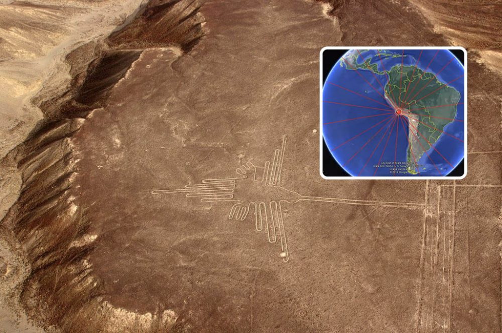
A new idea: mapping the Nazca Lines across the globe
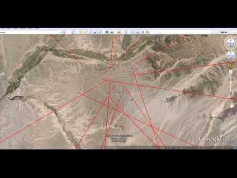
While experts continued to debate the meaning of the Nazca Lines, one YouTuber decided to look at them from an entirely different angle. Using Google Earth, he extended the longest lines across the planet to see if they intersected or pointed toward other ancient landmarks.
What he found was startling.
Some of the extended paths appeared to converge near Angkor Wat, the massive 12th-century temple complex in Cambodia. It’s one of the largest religious structures in the world and renowned for its astronomical precision and alignment with celestial events.
Could this be more than coincidence?
Antipodes: the Earth’s opposite point
The idea took on even more weight when the researcher explored the concept of antipodal points—locations that sit directly opposite each other on the globe. When tracing the Nazca region’s antipode, it lands remarkably close to Angkor Wat.
To put it simply, the Nazca Lines and Angkor Wat sit almost directly opposite each other on the globe.
Some people chalk that up to coincidence. Others think it’s too precise to ignore—maybe even a clue that ancient cultures knew a lot more about Earth’s layout than we give them credit for. Whether it’s a case of forgotten knowledge or just geography playing tricks, the connection between these two ancient sites definitely makes you look twice.
Mapping the Nazca Lines across the planet doesn’t give us a final answer—but it does raise better questions. Did the people who built these places have some deeper understanding of the Earth? Could there be a hidden pattern behind the locations of the world’s oldest and most mysterious monuments?
We may never know for sure. But what’s clear is this: the Nazca Lines might not just be desert artwork. They could be part of something bigger—something we’re only beginning to notice.