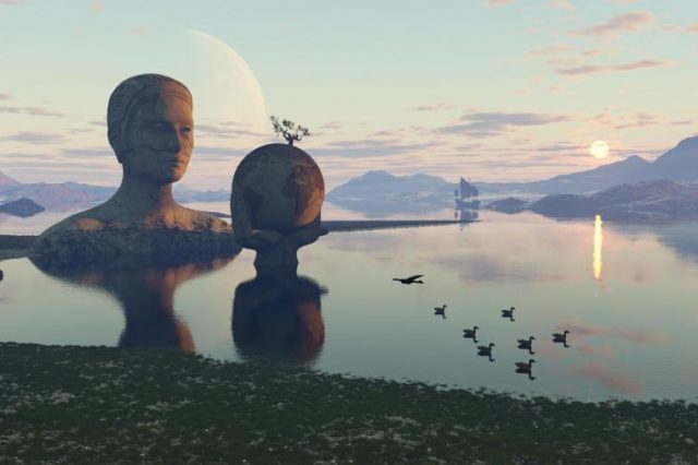
Beneath Europe’s southern edge lies something few people have ever heard of, and fewer still could imagine. It’s not a buried city or an ancient kingdom. It’s not Atlantis. It’s an entire forgotten continent, one that was lost for over a hundred million years. Today, thanks to a team of geologists and new technology, we finally know where it is, how it vanished, and how it reshaped the land we call Europe.
Its name is Greater Adria, and it may be the most important landmass in Earth’s history that no one ever told you about.
It wasn’t discovered by explorers. There were no temples, no inscriptions, no ruins rising from the sea. This forgotten continent under Europe was revealed through stone, pressure, and patience. As experts would put it, one layer at a time. And its story rewrites everything we thought we knew about the Mediterranean world. My world.
A tropical continent with no name
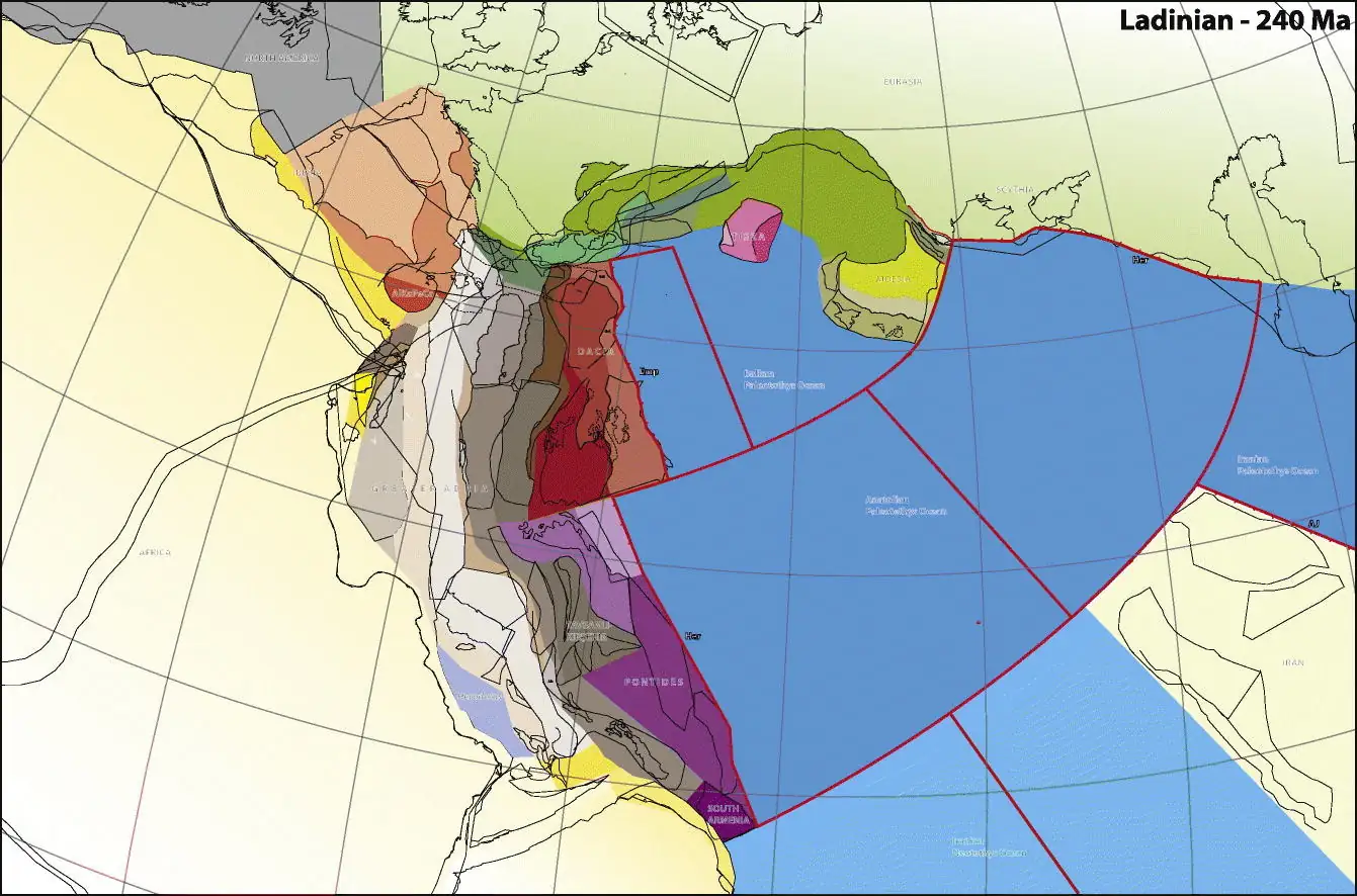
Greater Adria formed roughly 240 million years ago, when the supercontinent Gondwana began to fracture. A large piece broke away, warm, shallow, and surrounded by coral seas. For tens of millions of years, it drifted slowly across the Tethys Ocean. It was a quiet land, mostly submerged, rich in marine life, and still untouched by anything resembling humanity.
Then, about 120 million years ago, the movement of Earth’s plates brought Greater Adria to the edge of a collision. The Eurasian Plate was in its path. The result was not a sudden disaster, but a slow, brutal process that lasted over 100 million years. Bit by bit, Greater Adria was pulled under. Some of it broke apart and was scraped upward into new mountain ranges. The rest was dragged deep into the planet.
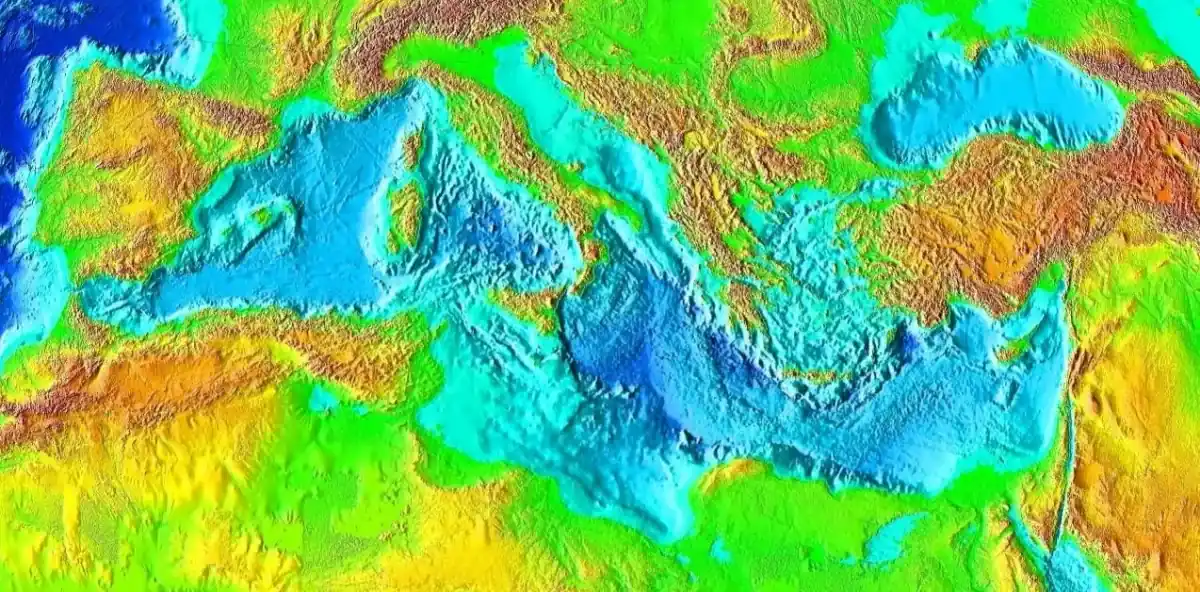
Today, most of it is gone. It is hidden thousands of meters beneath the surface, sealed in the Earth’s mantle. What remains above ground is fragmented, scattered across the Alps, the Balkans, and even parts of Turkey and the Middle East. And yet, its fingerprints are everywhere: in the stone, in the mountains, in the shape of the land itself. I find that so cool.
The clues were always there
Scientists had noticed something strange about the rocks in the Alps and other parts of Southern Europe. Layers of marine limestone sat at the top of mountains. Fossils of sea creatures were found hundreds of kilometers from the nearest coast. Entire sections of the Earth’s crust seemed out of place, as if they didn’t belong to the Europe we know.
It wasn’t until Douwe van Hinsbergen, a geologist at Utrecht University, began studying these puzzles more closely that a theory took shape. Over ten years, he and his team built a digital reconstruction of Earth’s tectonic past, combining field data, seismic imaging, and plate motion simulations. What they found wasn’t just an explanation for misplaced rocks, it was the outline of an entire continent.
They named it Greater Adria, after the Adriatic region where many of its exposed remnants were first studied. But the continent itself was far larger than modern-day Adriatic Europe. It once covered a stretch of terrain nearly the size of Greenland, and its collision with Eurasia shaped the geology of a dozen countries.
And this lost continent was very, very important. Without its disappearance, there would be no Alps. No Dinaric Alps. No Apennines. The very structure of Southern Europe, its fault lines, coastlines, and sediment layers, was carved out by the slow destruction of Greater Adria.
A buried continent that changed everything
One of the most remarkable parts of the story is how long this continent remained hidden. Unlike other lost landmasses, Greater Adria left no archaeological trace. No civilization ever rose on its surface. It sank long before the first humans appeared. And because most of it lies so far underground, scientists only detected it using seismic tomography, a method that allows researchers to visualize the Earth’s interior by tracking how waves from earthquakes move through different materials.
What they saw was astonishing. Long, twisted slabs of ancient crust were still down there, embedded in the mantle. They had been dragged beneath the Eurasian Plate during subduction, a process where one piece of Earth’s crust slides beneath another. It was the silent end of an entire continent.
And yet, in a way, it never truly disappeared. The limestone cliffs of Italy. The rugged peaks of the Alps. The strange distribution of fault zones across the Mediterranean. All of these are pieces of the same puzzle. They are physical traces of the forgotten continent under Europe, scattered like bones, waiting to be recognized.
What else is hiding beneath our feet?
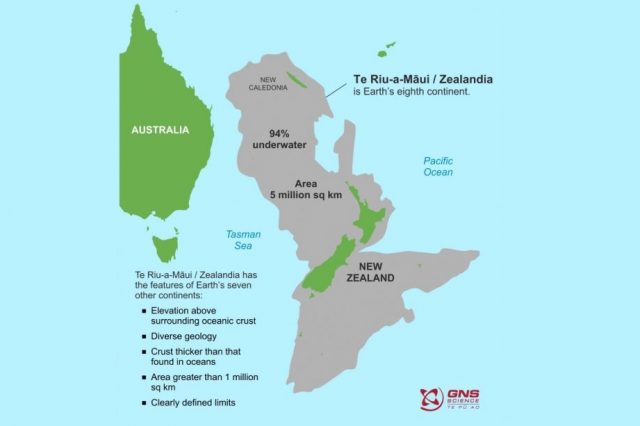
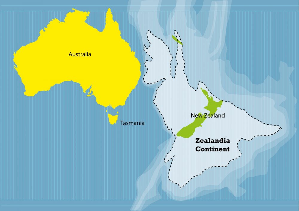
Greater Adria is now part of a growing list of lost continents. Zealandia, the nearly submerged landmass east of Australia. Mauritia, once part of ancient India, now scattered beneath the Indian Ocean. Argoland, still poorly understood, may lie beneath Southeast Asia.
These aren’t legends. They’re real places. Once part of the world’s surface, now broken apart and buried so deep they almost disappeared from memory.
Finding them isn’t just about drawing new lines on a map. It changes how we think about the ground beneath us. The Earth is always moving. Continents shift, oceans close, mountains rise where there was once sea. A place like Greater Adria didn’t just vanish overnight. It was pulled apart slowly, crushed and scattered, until there was almost nothing left.
It makes you see Europe differently. Not as something finished or unchanging, but as a surface built on top of another. The continent I live on was shaped by destruction. Something older came before it, drifted quietly across ancient waters, and was slowly swallowed by the land we now call home. And maybe the most surprising part is that we’re only just starting to uncover what else might still be hiding far below our feet.