Google Maps revealed ancient monuments that had remained invisible for thousands of years — until a perfect mix of drought, technology, and sharp observation exposed them to the world.
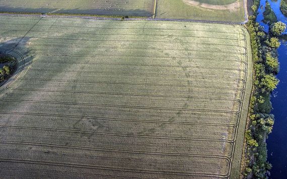
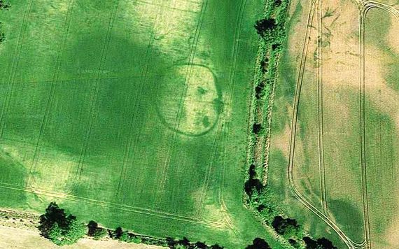
In 2018, Ireland faced one of its worst droughts in decades. Across the countryside, the landscape changed. Grass dried out, crops withered, and strange markings began appearing in fields. Aerial images showed circles, rectangles, and long ditches in patterns no farmer had planted.
At first, they looked like random soil discoloration. But in truth, these shapes were the outlines of ancient structures, buried beneath the earth — finally exposed by lack of moisture and captured by satellites.
How Google Maps revealed ancient monuments during a drought
Photographer and author Anthony Murphy had been documenting ancient sites for over 20 years. But during the 2018 drought, he used a different tool: Google Maps.


After noticing strange shapes in recently updated satellite images, Murphy realized they were archaeological in nature. Over time, he and others identified more than 50 ancient sites, many completely unknown before.
“The ditch features retain whatever trace moisture is in the ground a little more effectively than the surrounding soil,” Murphy explained. “From the air, what you get is a contrast between the healthier and less healthy crops, revealing the shape and size of the structures beneath the surface.”
What looked like ordinary farmland was actually home to ringforts, burial mounds, enclosures, and even ceremonial platforms — some dating back 6,000 years.
The largest site spotted in Google Maps imagery was a 350-meter-wide enclosure in County Dublin. Dozens of others measured between 20 and 100 meters across. These discoveries showed that Irish land is layered with forgotten history — much of it never excavated, let alone seen.
What the images tell us about ancient life
Because the monuments are hidden underground, they only appear when specific environmental conditions are met. The 2018 drought created those conditions by dehydrating the upper soil layers, allowing buried stone ditches to retain more moisture than surrounding dirt.
The difference caused crops growing above the ditches to appear greener, creating visible patterns when viewed from above — especially in satellite images. That’s how Google Maps revealed ancient monuments that weren’t visible in previous years.
According to Murphy, this wasn’t the first time Ireland’s ancient secrets were uncovered by extreme weather. Similar discoveries happened during a drought in 1976, though satellite imagery wasn’t available back then.
A new tool for archaeologists
Google Maps and satellite data have become unexpected allies in archaeology. These tools offer a way to monitor large areas quickly — especially regions like Ireland, where much of the countryside is covered in grass or crops.
Thanks to publicly accessible imagery, discoveries that once required boots on the ground now start from space.
Murphy explains that many of the newly identified structures were likely used for agriculture, ceremonies, or burial. In some cases, people have been unknowingly farming or building over them for generations.
“It’s an insight into agriculture and life in general in previous times,” Murphy said. “People have been farming the land in Ireland for around 6,000 years. The evidence of their settlements, and indeed their farms and of course their burial grounds, are literally everywhere.”