Archaeologists have returned to a rare Iron Age fort in Shropshire that sits in a wetland landscape rather than on a hill. The University of Birmingham has begun a new, ten-year project at Wall Camp near Telford, reopening a site that had not seen a major excavation since the 1980s.
The first three-week season took place in June. More than 60 students and researchers opened three trenches to examine the fort’s entrance, banks, ditches and internal buildings. The work is not being presented as a finished discovery. It is the first stage of a longer attempt to understand a monument whose layout raises more questions than it answers.
A fort in an unexpected place
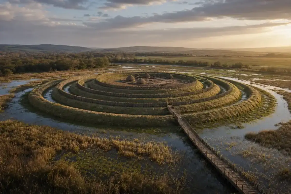
Most Iron Age forts in Britain occupy high ground. Height offered a clear view across the surrounding country and made an approach easier to control. Wall Camp is different. It stands on a raised island within the Weald Moors, a landscape that was once a boggy woodland and is now drained peatland farmland.
The site is one of the best-preserved examples of a lowland or “marsh fort” in Britain. As many as five concentric earthworks surround the central area. From above, the banks and ditches form a set of rings, but that neat outline does not explain how people moved through the fort or what each line was meant to do.
One of the strangest features is a series of causeways that appear to lead nowhere. The team is testing whether they were entrances, platforms, routes across wet ground or parts of a plan that has been altered by later activity. The apparent dead ends may also be the result of erosion, farming or incomplete excavation, so the researchers are keeping the interpretation open.
Earlier finds hint at a busy place
Previous work found Iron Age roundhouses, pottery associated with regional salt-trading networks and a small blue glass bead made with unusual skill. Those objects place Wall Camp within a wider network, but they do not yet tell us whether the fort was a permanent settlement, a defended refuge, a meeting place or a site used for particular ceremonies.
The position of the modern farmhouse adds another layer. It sits over the remains of Iron Age roundhouses and may also preserve evidence of a medieval settlement that has not been recorded before. Each period has left traces in the same ground, which means the excavation has to separate later changes from the original design of the fort.
What the new excavation can answer
The team is concentrating first on how people entered and left the site. That sounds basic, but entrances often reveal the social purpose of a fort. A narrow, controlled approach can indicate defence. A broad route with carefully staged views may have guided visitors into a space used for gatherings or display.
Researchers also want to date the earthworks and understand the wetland around them. Pollen, seeds, charcoal and animal bones can show whether the moor was used for grazing, cultivation, fuel gathering or deliberate flooding. The waterlogged ground may preserve organic material that usually disappears from Iron Age sites.
There is no single “mystery” answer waiting in the soil. The value of Wall Camp lies in its combination of unusual setting, large earthworks and a record of earlier finds. Over the coming seasons, the project should show whether the fort was built in one campaign or expanded over generations, and how its builders used a landscape that would have been difficult to cross.
For now, Wall Camp is best understood as a rare example of Iron Age engineering in a wetland environment. The next excavations will decide whether its puzzling lines were practical, symbolic or both.
For another recent excavation with a very different setting, read Curiosmos’ report on the rare Neolithic tombs found together in Galway.