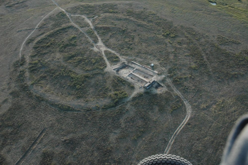
More than 4,000 years ago, ancient people in present-day Russia built a true ancient wonder. Comparable in complexity to Stonehenge, an ancient society envisioned a settlement shaped like a circle, with external and internal walls rising into the air nearly six meters. Inside, residential areas were built attached to the walls. It was kind of like a miniature version of Plato’s Atlantis. At the center of the structure was an area where all streets lead directly. Although it was not built of stone like Stonehenge, given the site’s peculiar design, experts refer to it as the Russian Stonehenge.
Arkaim, built by a mystery culture
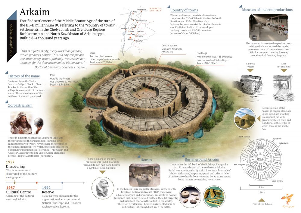
Whoever built the site did so by carefully planning it. Nothing was left to chance. In its prime, Arkaim covered around 20,000 square meters (220,000 square feet), and the diameter of the enclosing wall was around 160 meters (520 feet). Furthermore, the walls of the citadel range from 4 to 5 meters (13 to 16 feet) in thickness, with a height of 5.5 meters (18.04 feet).
A skilled culture
Archeological surveys of the site have revealed that the people who built Arkaim were farmers, hunters, and warriors. They were skilled in creating pottery and textiles but also capable farmers and fearless warriors. The ancient settlement was prosperous, and there are traces of year-long habitation. It was a perfect little settlement, and there were no apparent reasons why people would abandon their fortress.
However, for reasons that remain unclear, they left, and scientists have still not figured out what caused the demise of Arkaim. The site is attributed to the early Proto-Indo-Iranian Sintashta culture.
A complex citadel
The fortified citadel of Arkaim dates back-—at least—to the 17th and 16th centuries BC. More than twenty other structures built according to similar patterns have been found in a larger area spanning the southern Ural region to northern Kazakhstan, forming the so-called “Country of Towns“. Archaeological excavations near Arkaim have revealed evidence of a complex society, suggesting that the southern Urals were a key location in developing technology and complex civilization. Arkaim only confirms this.
Arkaim was a revolutionary citadel. It consisted of two concentric bastions constructed out of adobe with timber frames. These were then covered by unfired clay bricks. Inside the bastions, researchers have found traces of at least sixty dwellings. These dwellings featured hearths, wells, and metallurgical furnaces, suggesting that the inhabitants of Arkaim were skilled metalworkers.
A circular citadel
All of these structures lad towards an inner circular street. The streets, in turn, were lined by covered drainage with pits that helped collect rainwater. At the heart of the citadel stood a rectangular open space. Araim had four main entrances, intricately constructed passageways and was precisely oriented to the cardinal points. This peculiarity suggests that whoever built Arkaim did so with great care and a carefully planned layout. In turn, this tells that it is very likely that the builders of Arkaim were a society with a well-developed social structure and authoritative government.
Arkaim’s vast influence
Arkaim’s zone of influence stretched even outside of its mighty walls. Researchers have uncovered traces of arable fields irrigated by canals and ditches. It is estimated that around 2,000 people lived inside the citadel. Scholars have identified the structure of Arkaim as the cities built “reproducing the model of the universe” explained in ancient Aryan/Iranian spiritual literature, the Vedas and the Avesta. Eventually, the entire citadel was burned and abandoned. Nonetheless, and despite its destruction, many elements have survived for archeologists to uncover, revealing a fascinating site full of history.
5 things you should know about Arkaim
- Arkaim’s exact builders continue eluding experts. Nonetheless, the site is attributed to the Proto-Indo-Iranian of the Sintashta culture.
- Located in the Steppe of the Southern Ural, the ancient city lies just north of the border with Kazakhstan.
- The settlement was gigantic, spanning 20,000 square meters, and likely played a central role in commerce and society.
- The construction of Arkaim dates back to around 1,800 BC.
- Although Arkaim is the largest, researchers have identified at least twenty similar structures following Arkaim’s intricate design.
Have something to add? Visit Curiosmos on Facebook. Join the discussion in our mobile Telegram group.